In late December headed to Cochamó, in southern Chile. A great area for backpacking and climbing, except for being very wet. Thankfully it only rained one day when I was there. And the humidity was a pleasant change form the Atacama Desert, which is so dry they have drip irrigation for the cactus gardens. And a nice change from Santiago, which is just too large of a city.
Access to Cochamó is by bus or plane to Puerto Montt, and then a 3 hour rural bus to Cochamó. It will leave you off at the bridge where the main road crosses the canyon. From there it is a 10km hike to the trail head. After that you head up the trail and hope for the best.
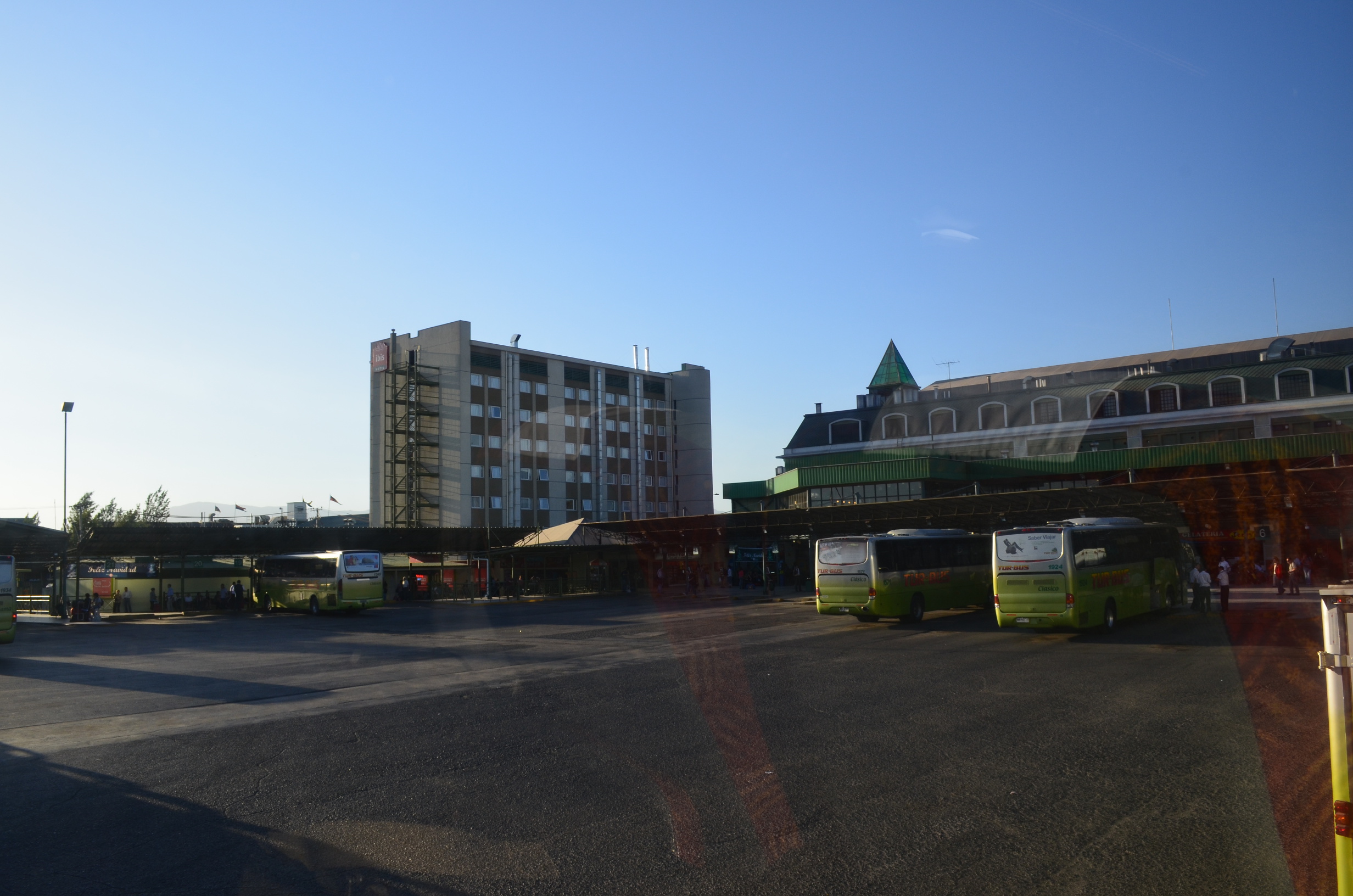
Travel by Bus
I took the Santiago Metro from my apartment to the one of the main Tur Bus stations. From there caught a bus south to Puerto Montt, a drive of over 1000km. Despite what Google thinks the trip was not 18 hours; it was closer to 14. It can also be done faster in a car; the buses in Chile must follow a lower speed limit, of which is actually enforced!
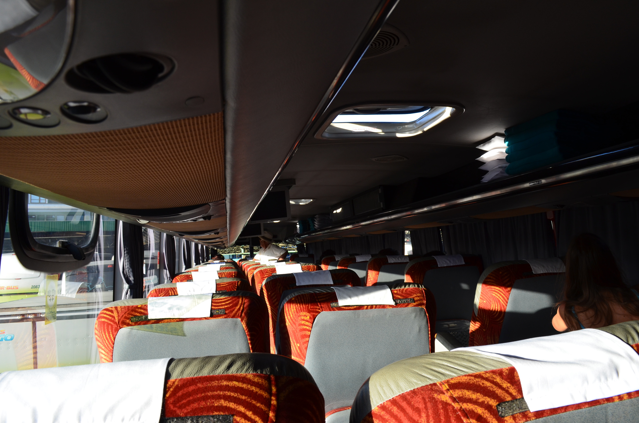
For the long ride I paid for the mid level setting in the bus, Salón Cama. Had I been 10cm shorter it would have been great. But, like many seats, it was designed for short people. Sure, there was enough room - but the shape of the seat was wrong for my back. I wish this problem was unique to Chile, but it is also common elsewhere. Nothing like a 14 hour trip in an undersized seat.
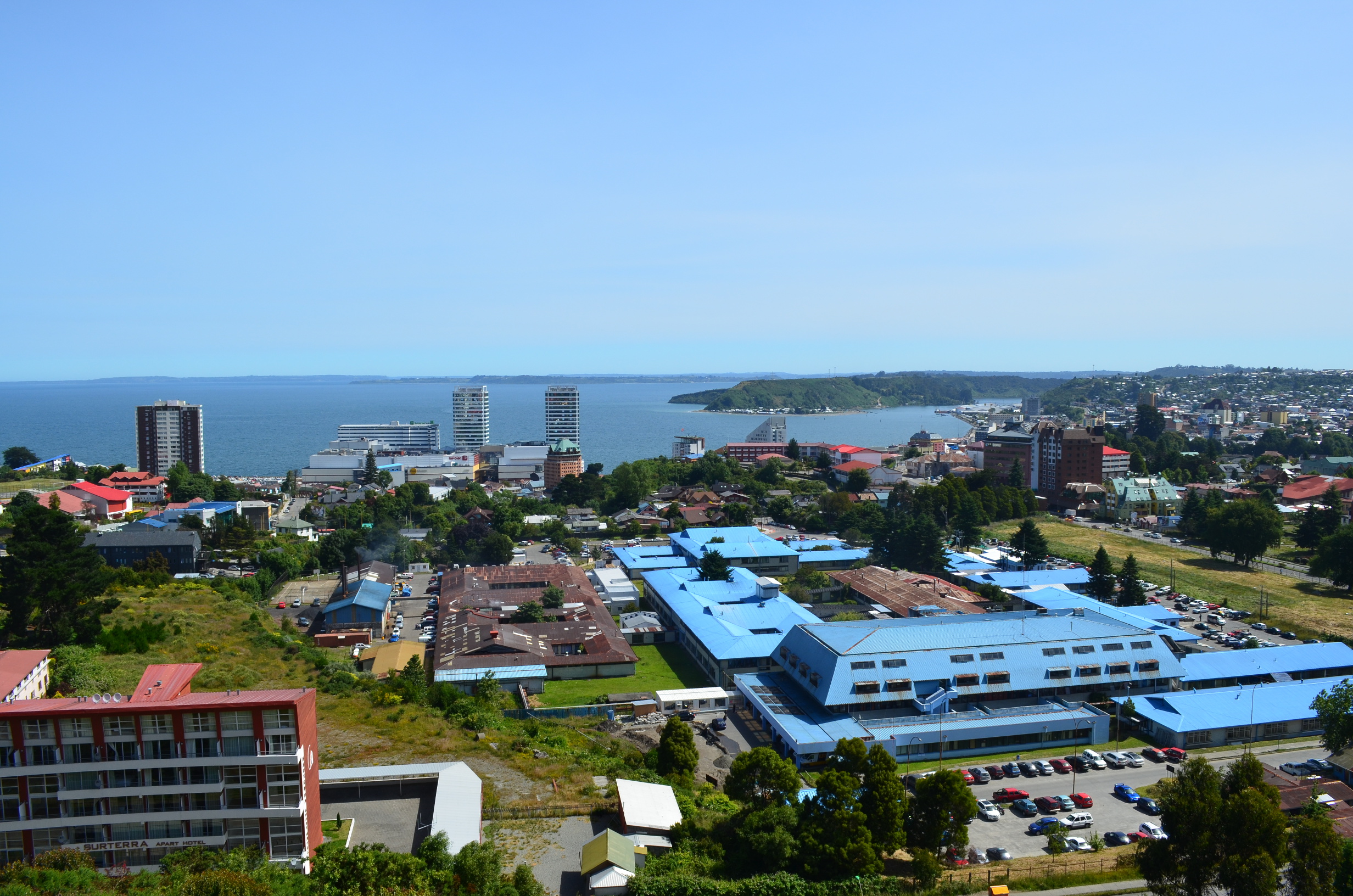
Puerto Montt
After a night of not much sleep I arrived in Puerto Montt. The only bus to Cochamó was scheduled to leave at around noon, so I had several hours in Puerto Montt. Thankfully there was a (somewhat) secure storage area where I could pay to leave my backpack, making it a lot easier to explore the town. I filled up my camp stove with unleaded from a gas station. The guy was a little confused by my wanting a 1 liter bottle of fuel, but sold me the fuel. And I even found a good coffee shop (something that is rare in Chile).
Hiking In
The bus left the Puerto Montt station a bit late, but I did not have any trouble catching it. Once riding on the bus I realized I could have gotten off the long haul bus sooner, in Puerto Varas; the local bus stopped there on the way to Cochamó. However, it would have been very hard to know exactly where to catch it and which bus to get on. And all I would have gained is more hours sitting around, and been in Puerto Varas not Purto Montt.
My goal was to hike up Cochamó valley, which intercepts the road a few miles south of the town of Cochamó. My Spanish wasn't good enough for real communication. I brought a map showing where I wanted to get off. When we got close I showed it to the driver and they happily left me there.
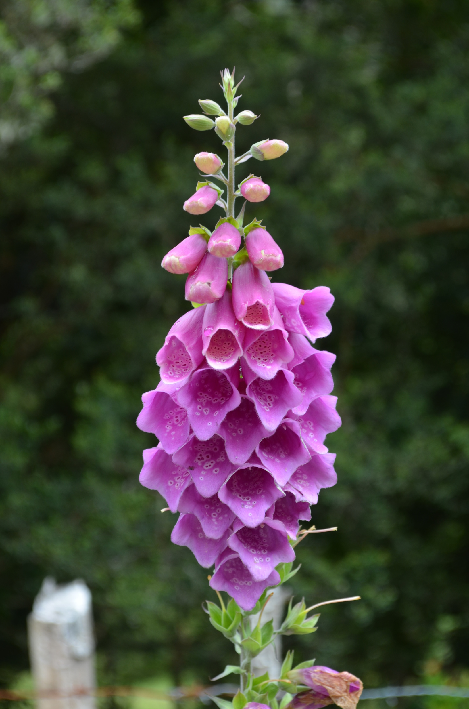
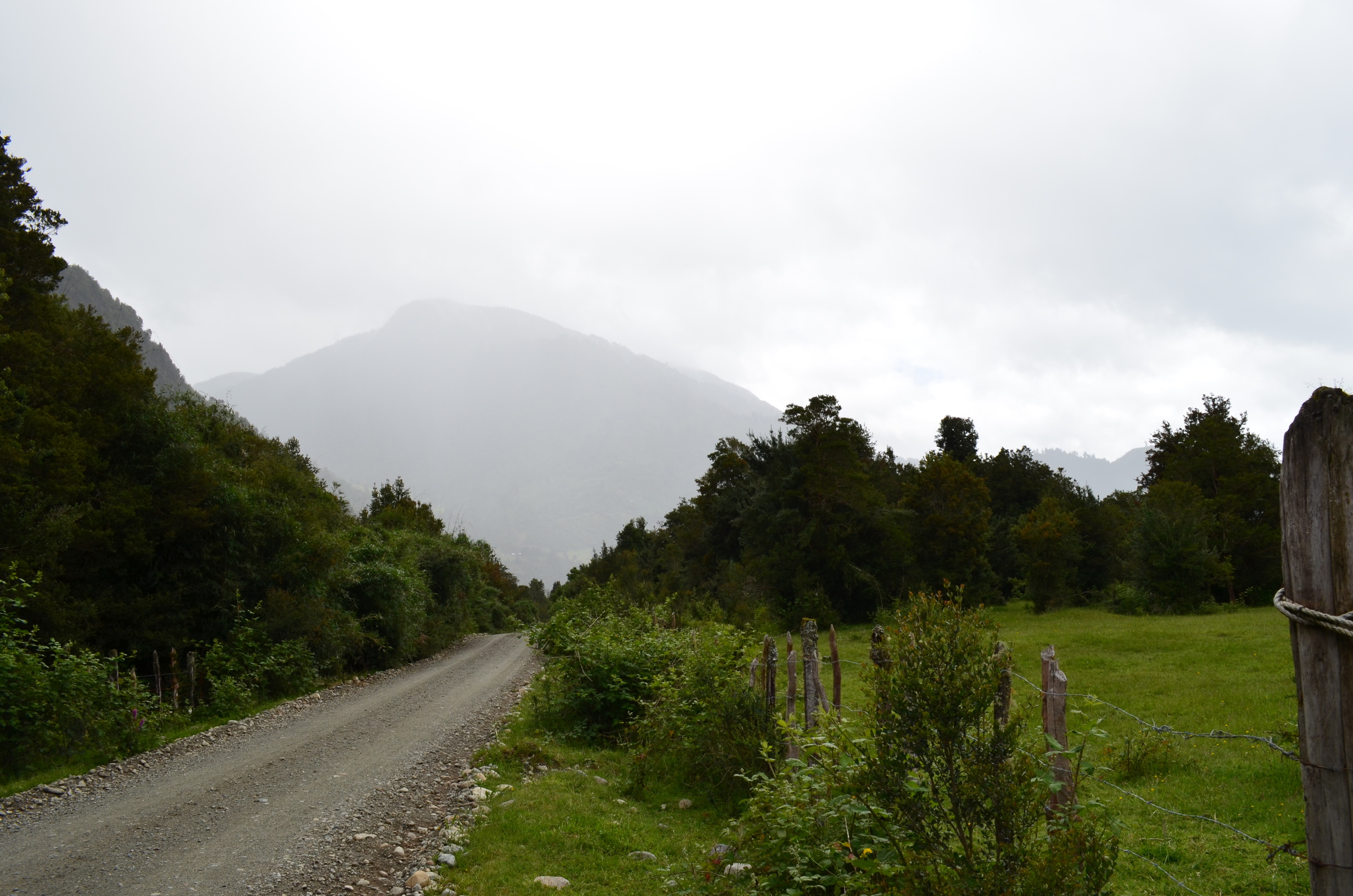
After that the backpack started with several kilometers up a dirt road to the trail head. The road was not what I call exciting, but there were some nice flowers.
As dirt roads go this one was nice for hiking down. Low traffic and no attack dogs. It was in good enough shape to drive a road car on, though there would be a few tricky spots. I don't know if that is always the case. I doubt they maintain it that often and it wouldn't take much damage to render it impassable to low clearance vehicles. There are a number of small farms in the area, several of which have bee hives.
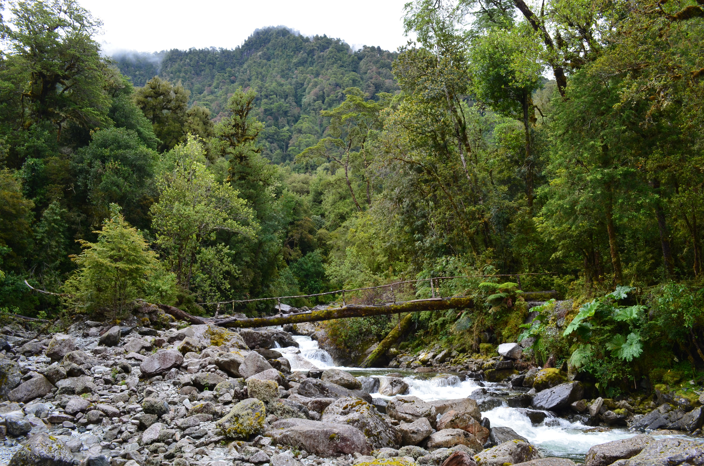
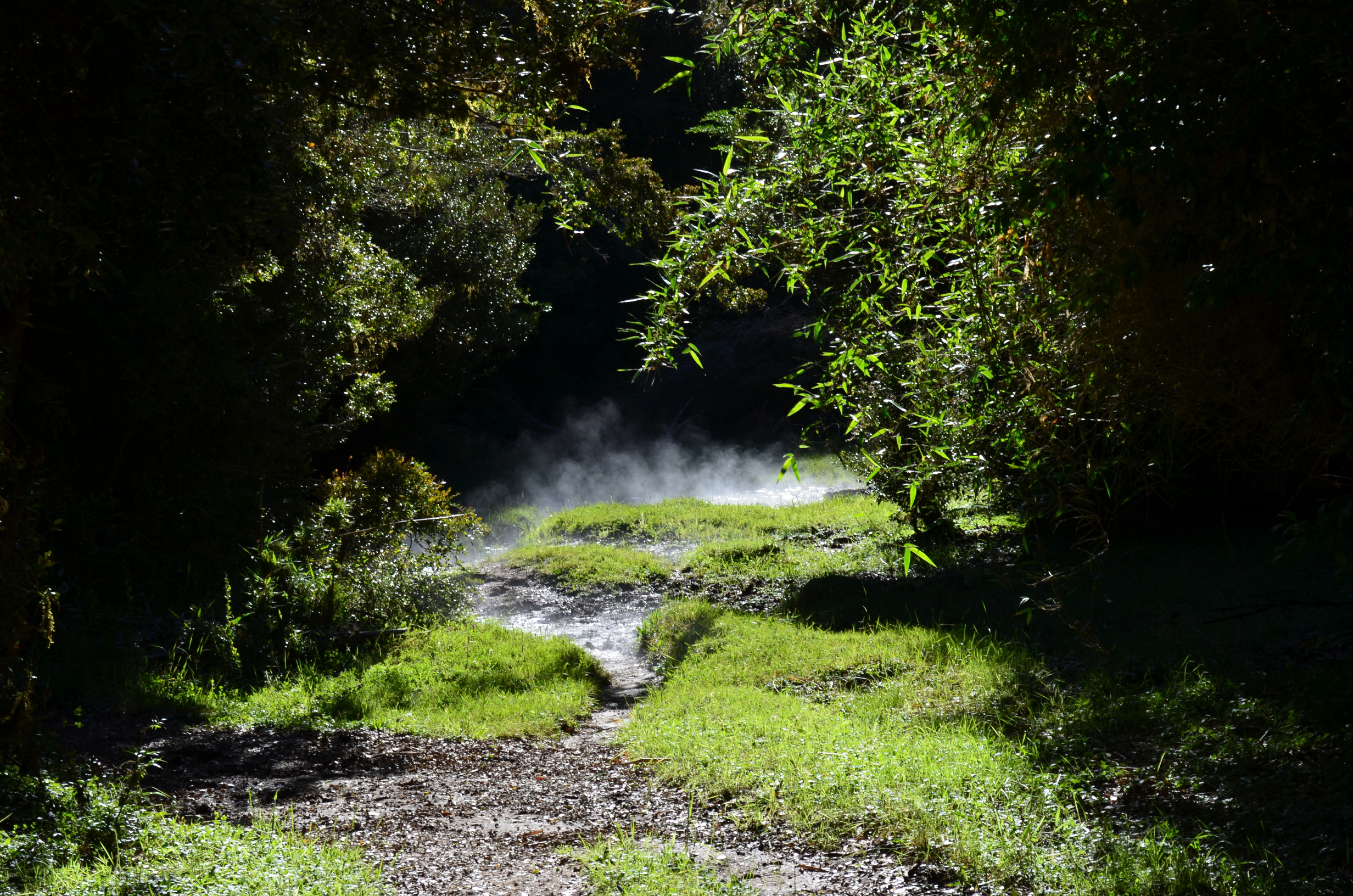
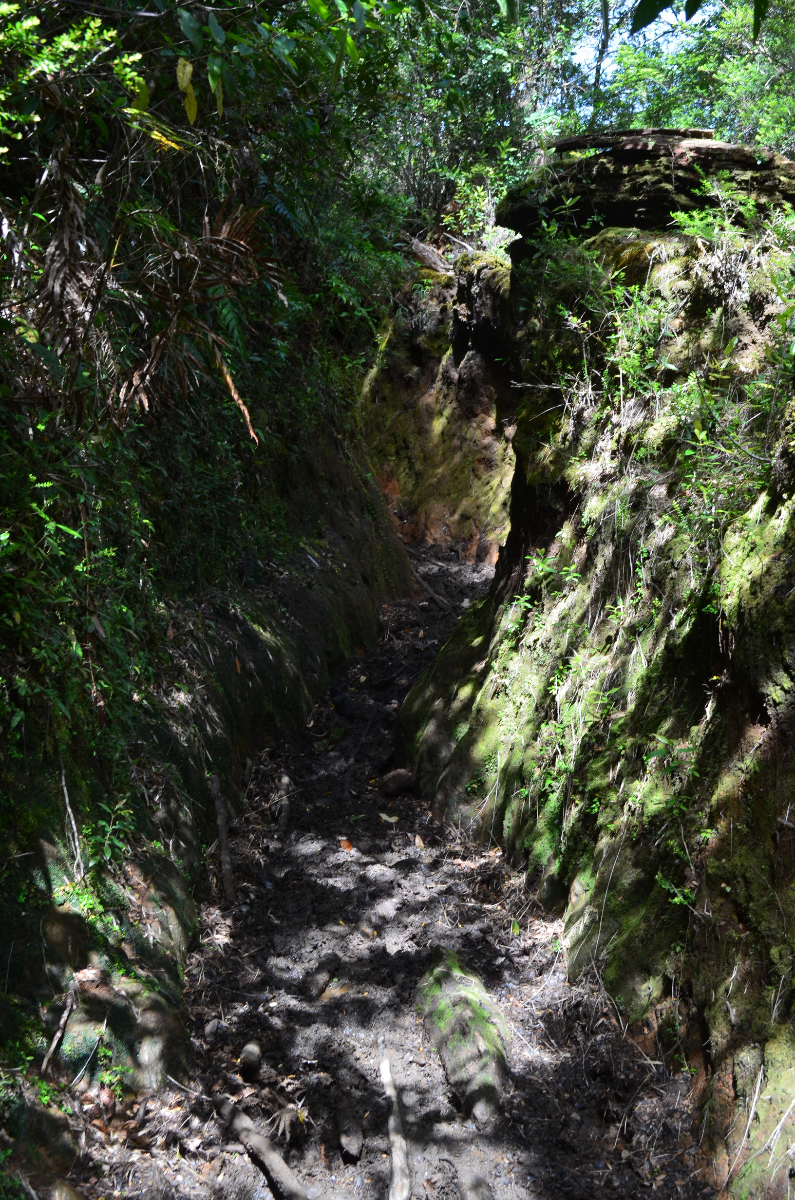
Long ago he dirt road went clear to Argentina. Now the road goes about 10km after which there is a sort of maintained trail. It has the same problems as any trail in a temperate rain forest - water, muck, down trees, vegetation overruns, and river crossings. They put a foot log over some of the larger side rivers, making the crossing far easier and safer during the spring melt.
Trail muck was very common. My strategy of hiking in sandals worked well. Easy to wade the muck, and then easy to wade the rivers (which washed off the muck).
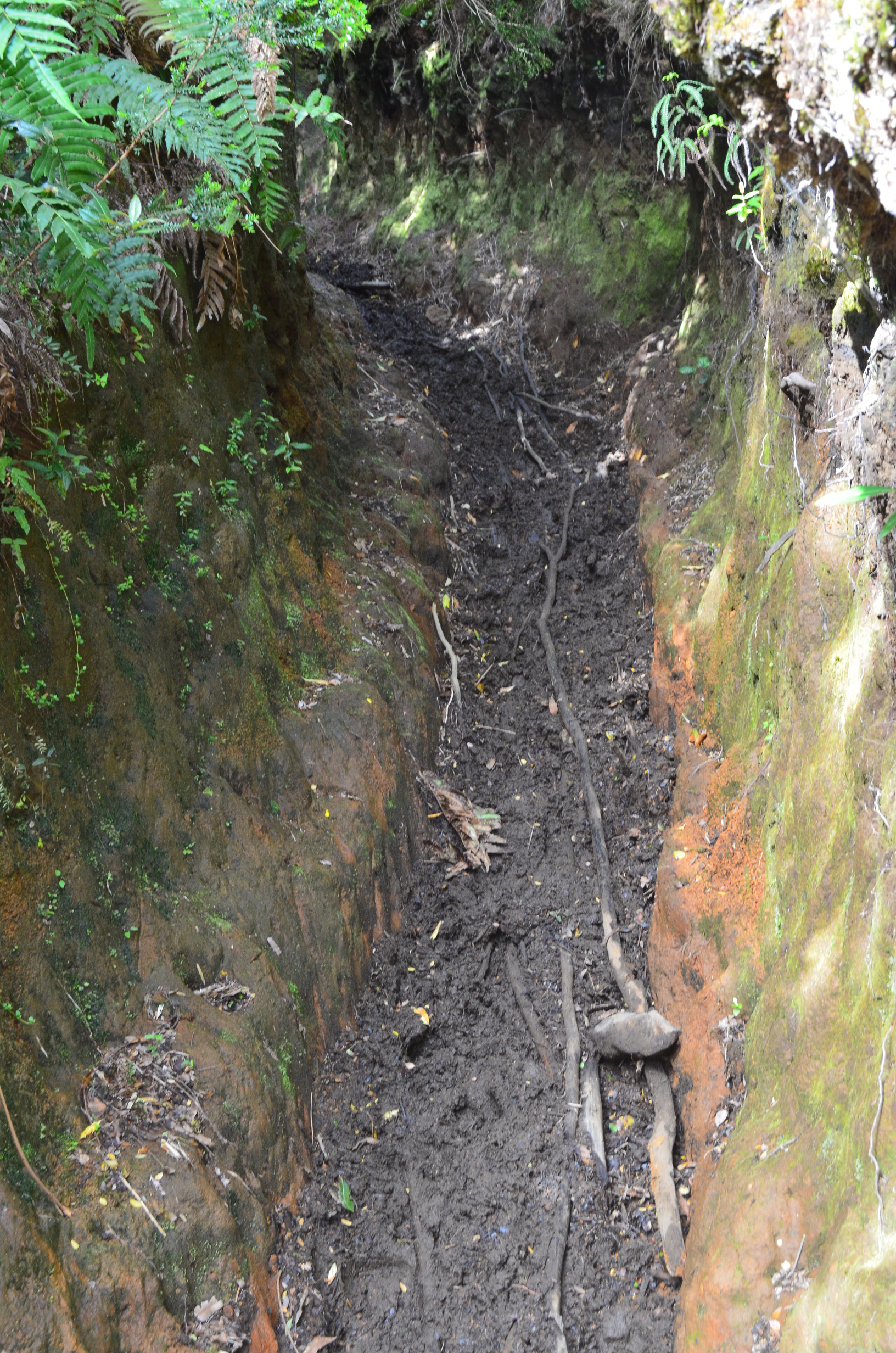
Sometimes you could walk around the muck. But often you couldn't. Trenches like this were common. Trying to go around them was difficult. The side of the trail was overgrown, had its own mud, and falling from the side of the trail into the middle (with a heavy backpack) would be dangerous. Hikers in the US should be thankful for the work that has gone into maintaing our trails.
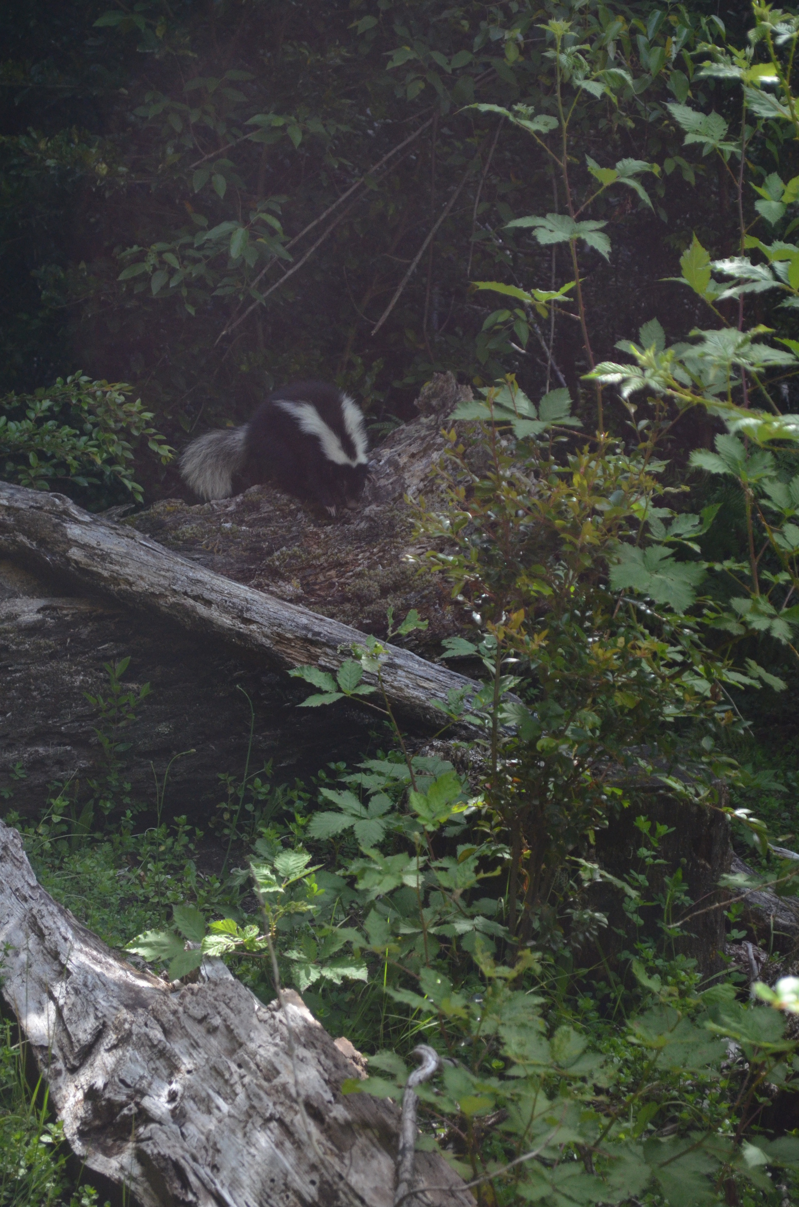
There was also a trailside skunk. Well, I think it was a skunk. It doesn't look quite like an North American skunk, but I figured it was best not to get too close anyway.
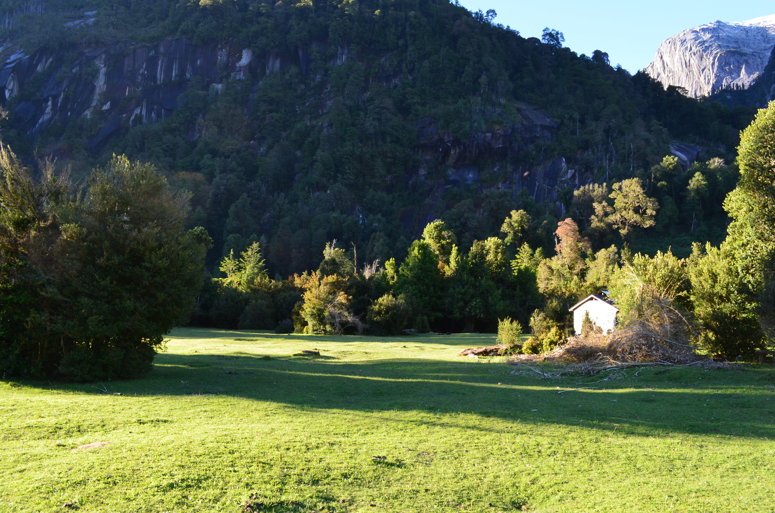
The main campsite was near the refugio, and they charged a few dollars to camp there. It doubled as a pasture - with the up side of shorter grass and the down side of scattered cow pies. And the occasional cow in camp.
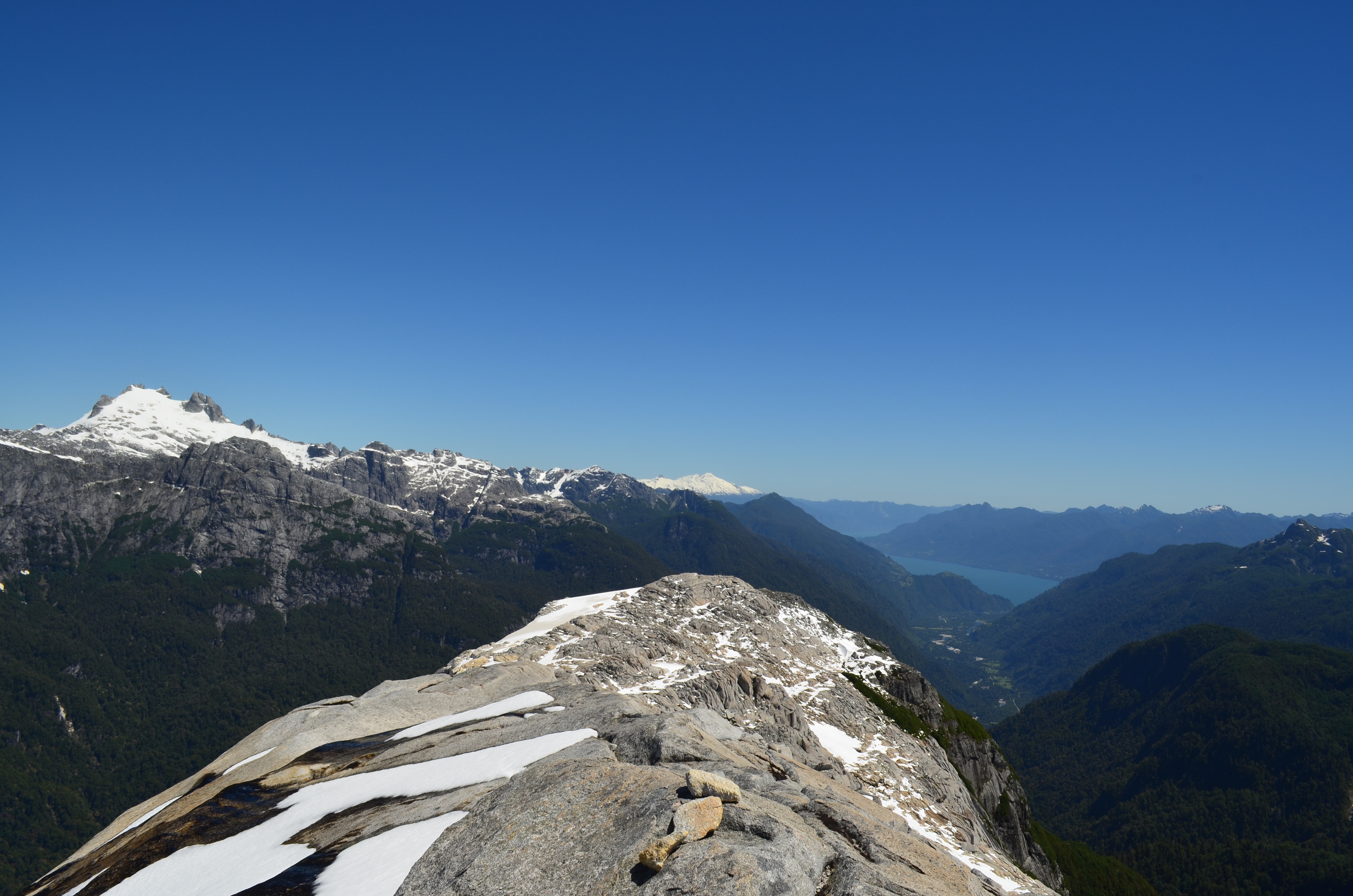
The view from the camp site explains why I went to all the trouble to get there.
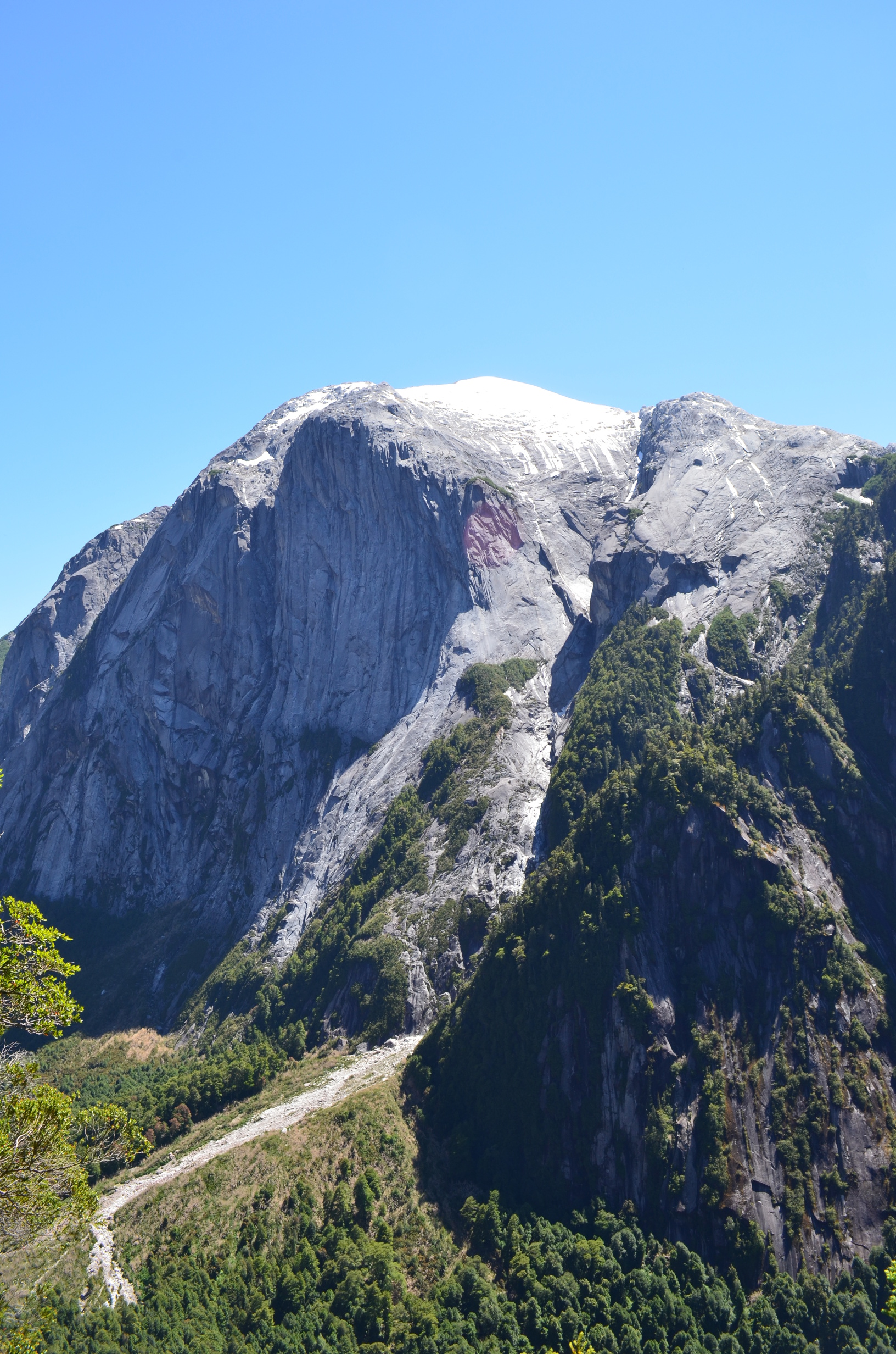
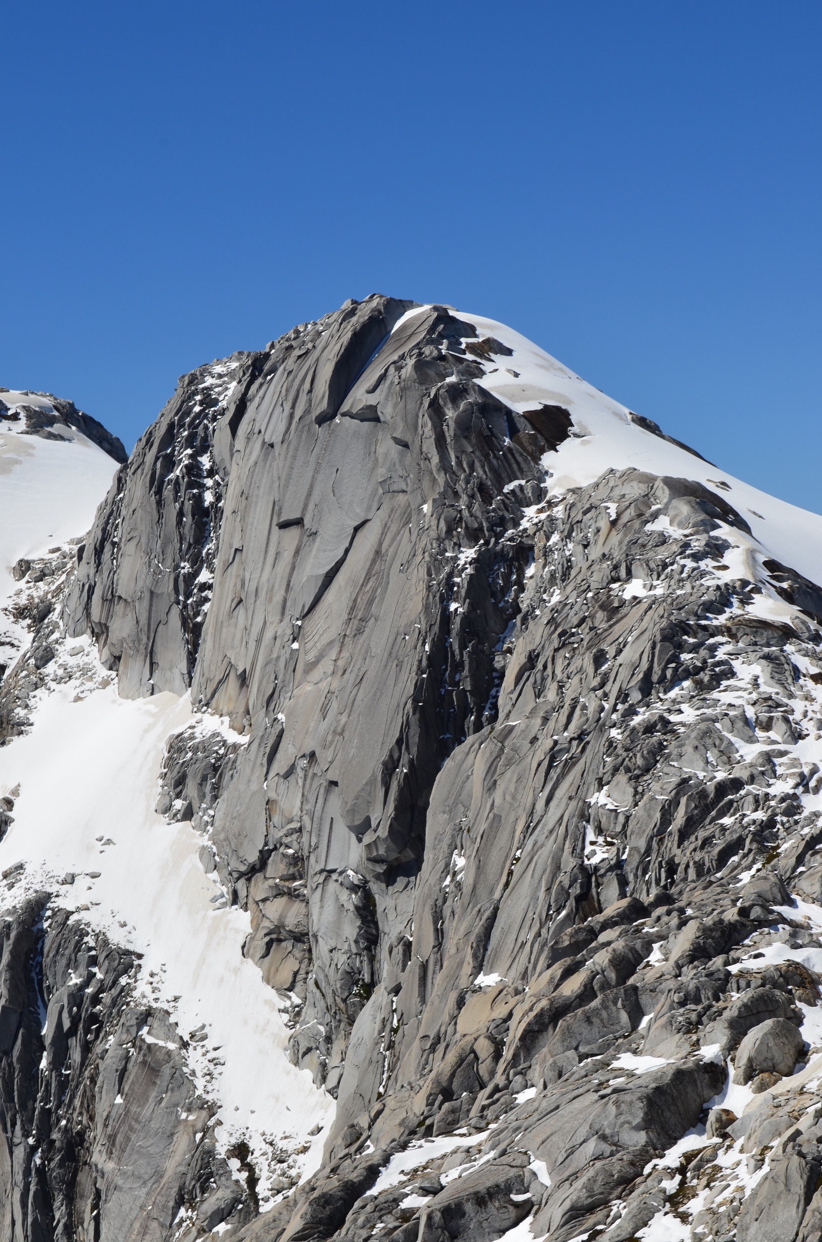
The following day I decided to climb Cero Arco Iris (Mt. Rainbow). The trail up was quite steep, with hand lines in places. Quite fun, but given the wet rock I wish I had a harness so I could clip in in case I slipped. Of course, if the rock was a bit dryer that would have been unnecessary.
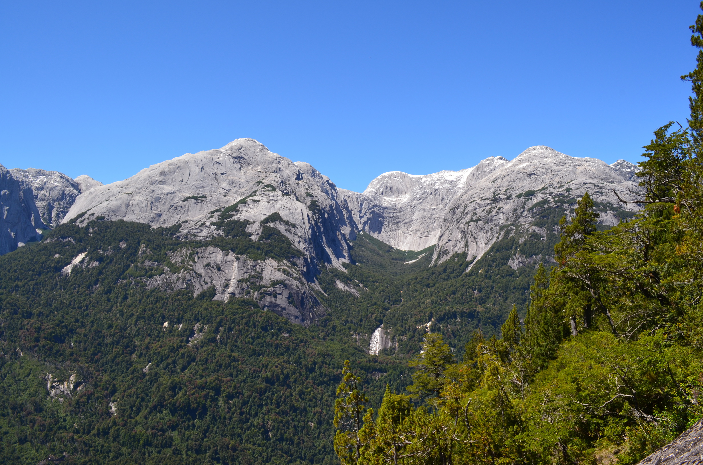
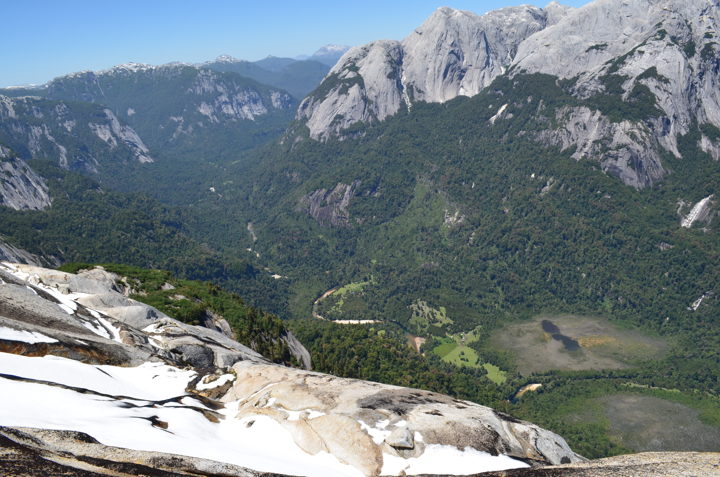
As I got higher up the mountain the view improved.
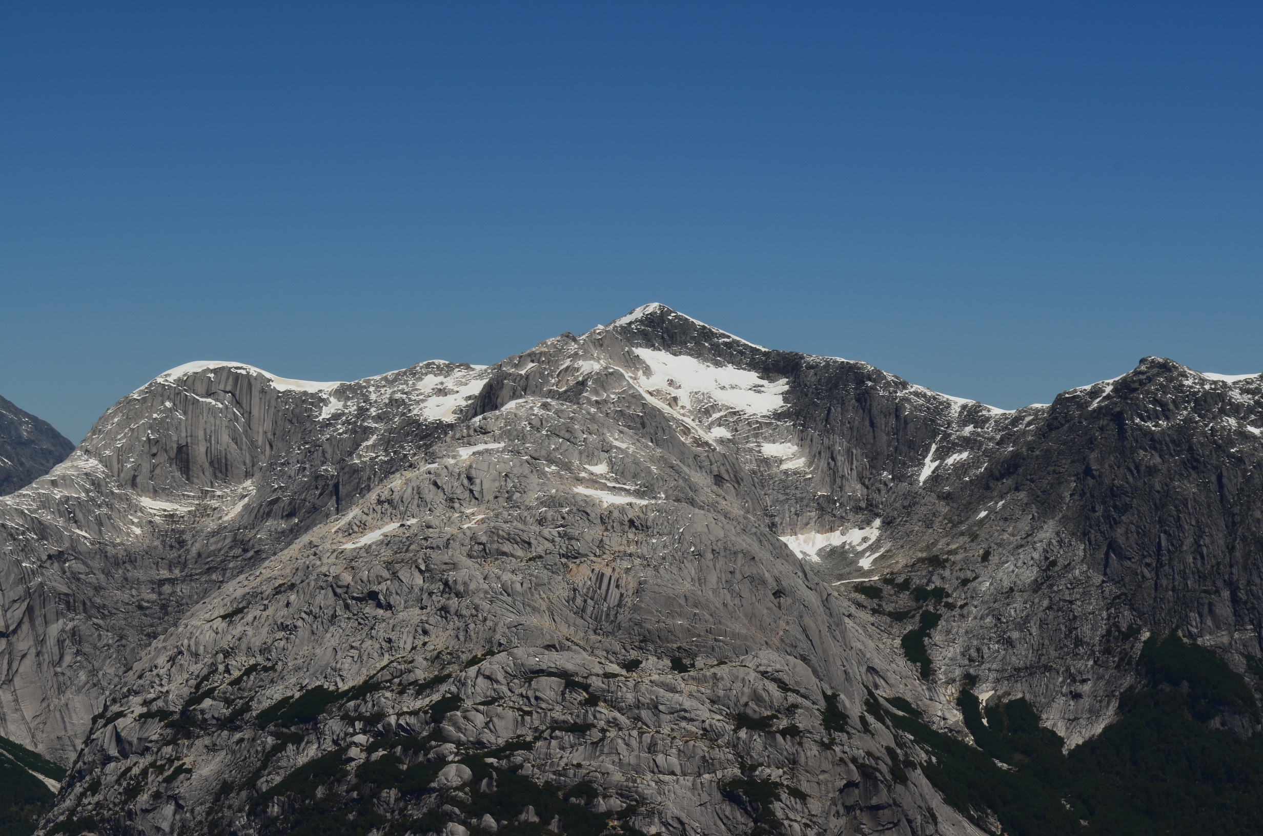
And the route up did not get any less intimidating.
The route goes up the rocky ridge to the left of the canyon until just below the snow line. Then it traverses around above the cliff. While the peak looks difficult it is non-technical.
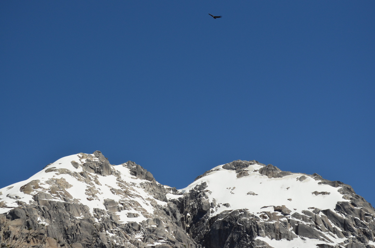
Meanwhile the birds circle overhead. Is that an Andean Condor, or just a generic large black bird? I can't tell.
Looking into the valley below I can see both the refugio and a small farm downstream from it. The farm is remarkably isolated; the only access is by horseback or foot.
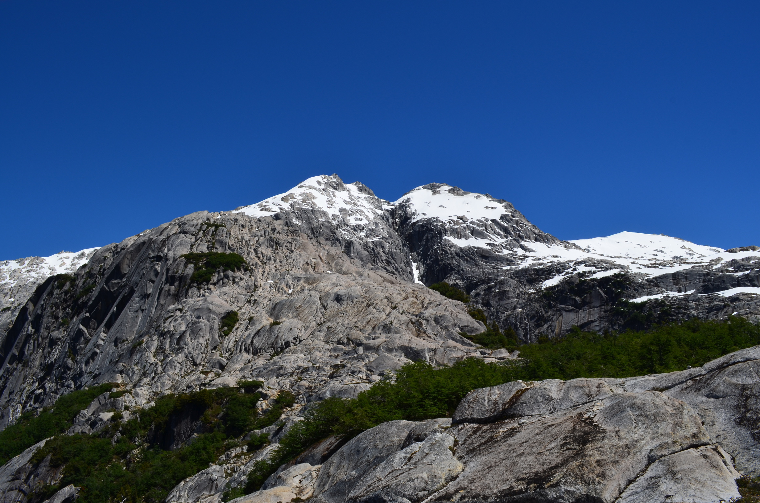
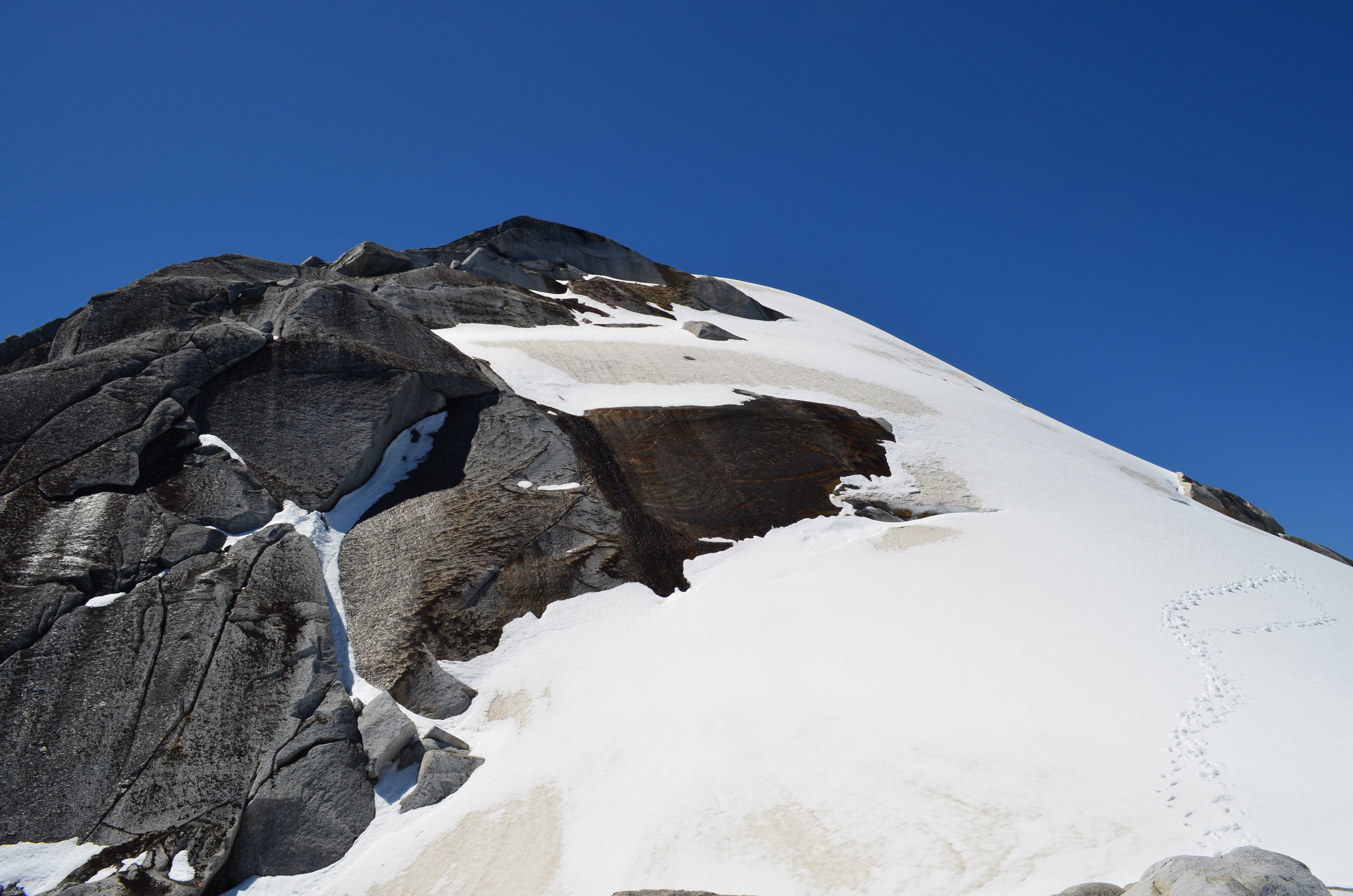
When I finally make it to the summit block there is a problem. The final slope is both very steep and covered in snow, with the usual soft layer over hard packed. It is also unclear which sections of snow are secure and which ones might slide right off.
I cautiously examine the snow slope. An uncontrolled slide would probably result in hitting a pile of rocks at high speed. Or flying off one of the cliffs below. If I had my ice ax there would be plenty of room to recover from a slip and safely stop. A rope and partner to belay would also work. But I am all alone, have no rope, and my ice ax is sitting in my closet 1000km north in Santiago. With regret I turn back. Climbing Mt. Rainbow just isn't worth dying for.
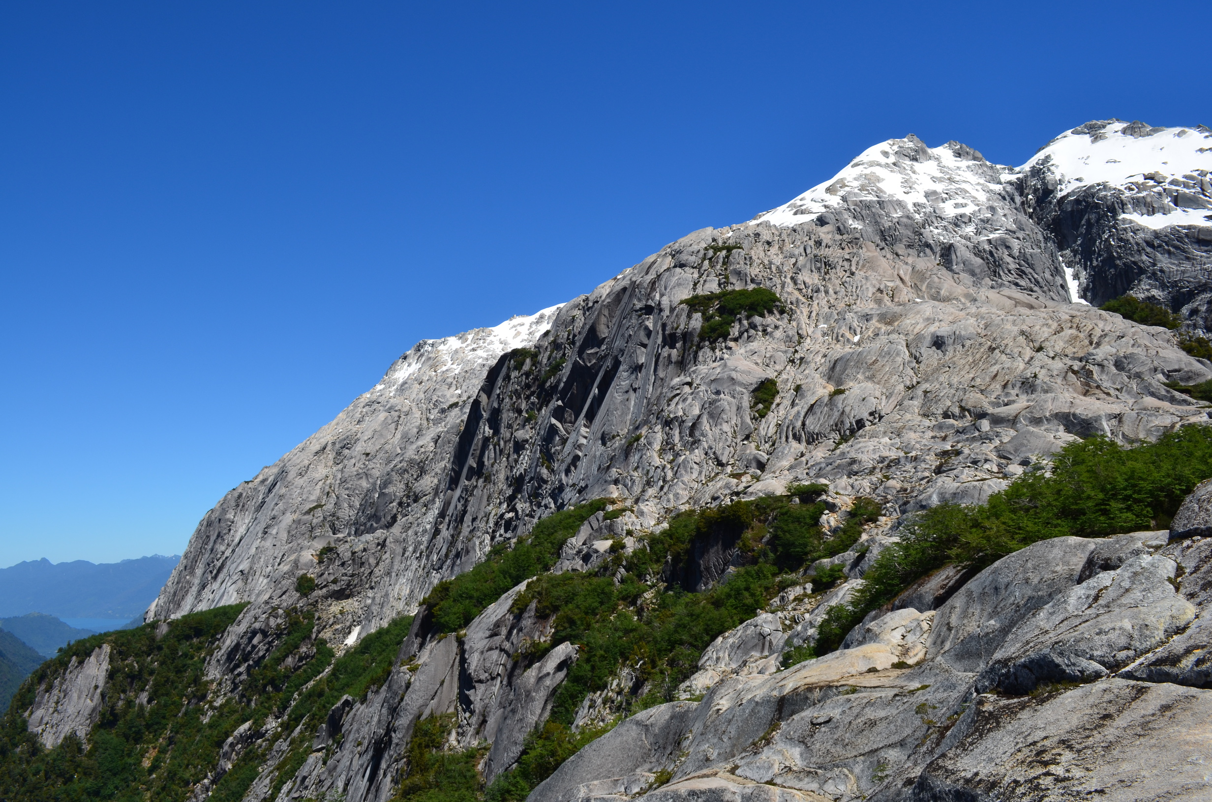
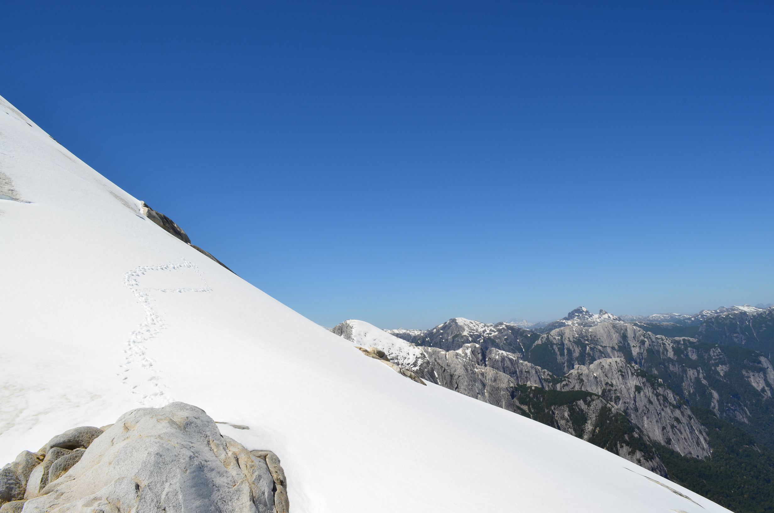
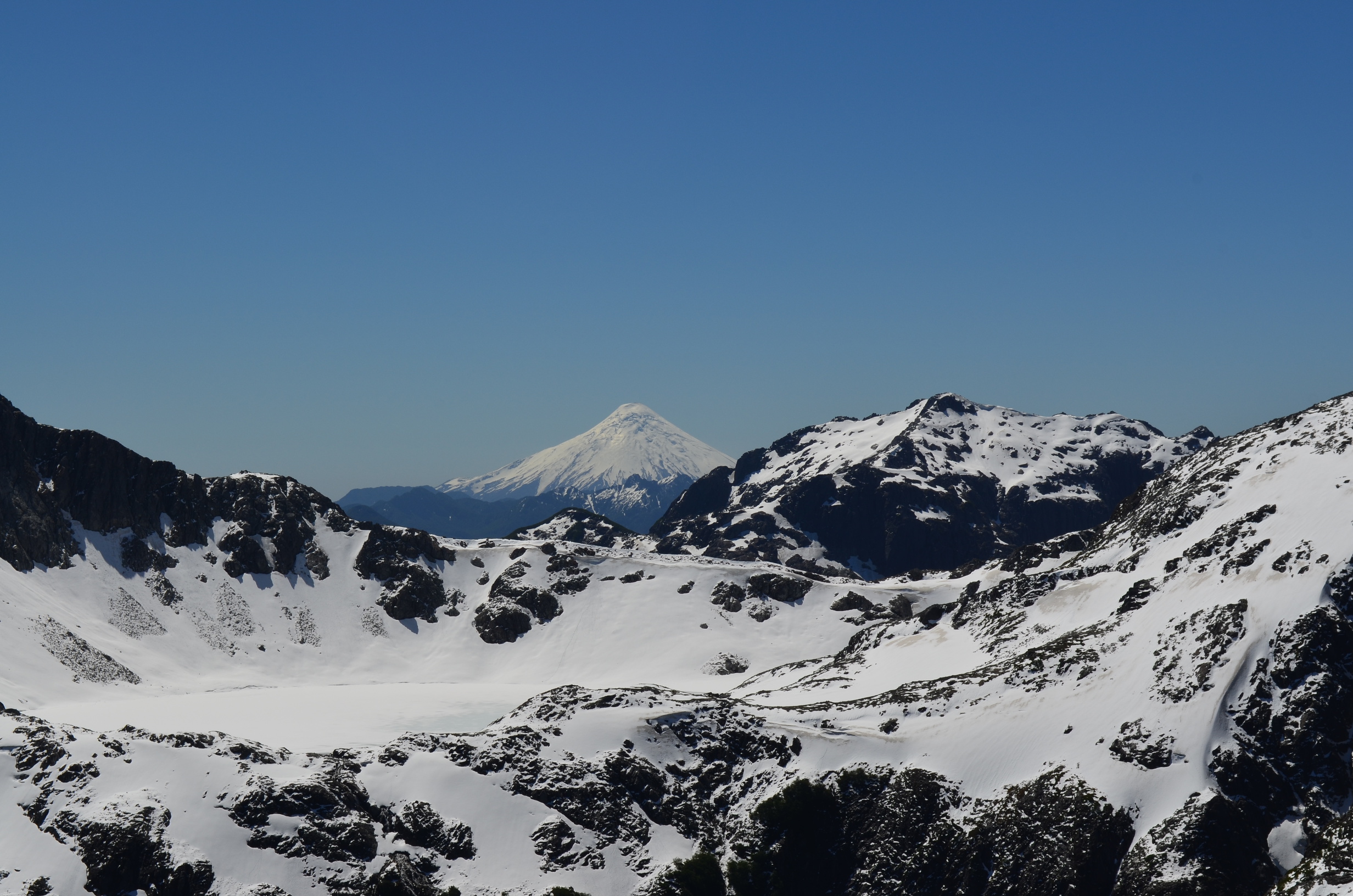
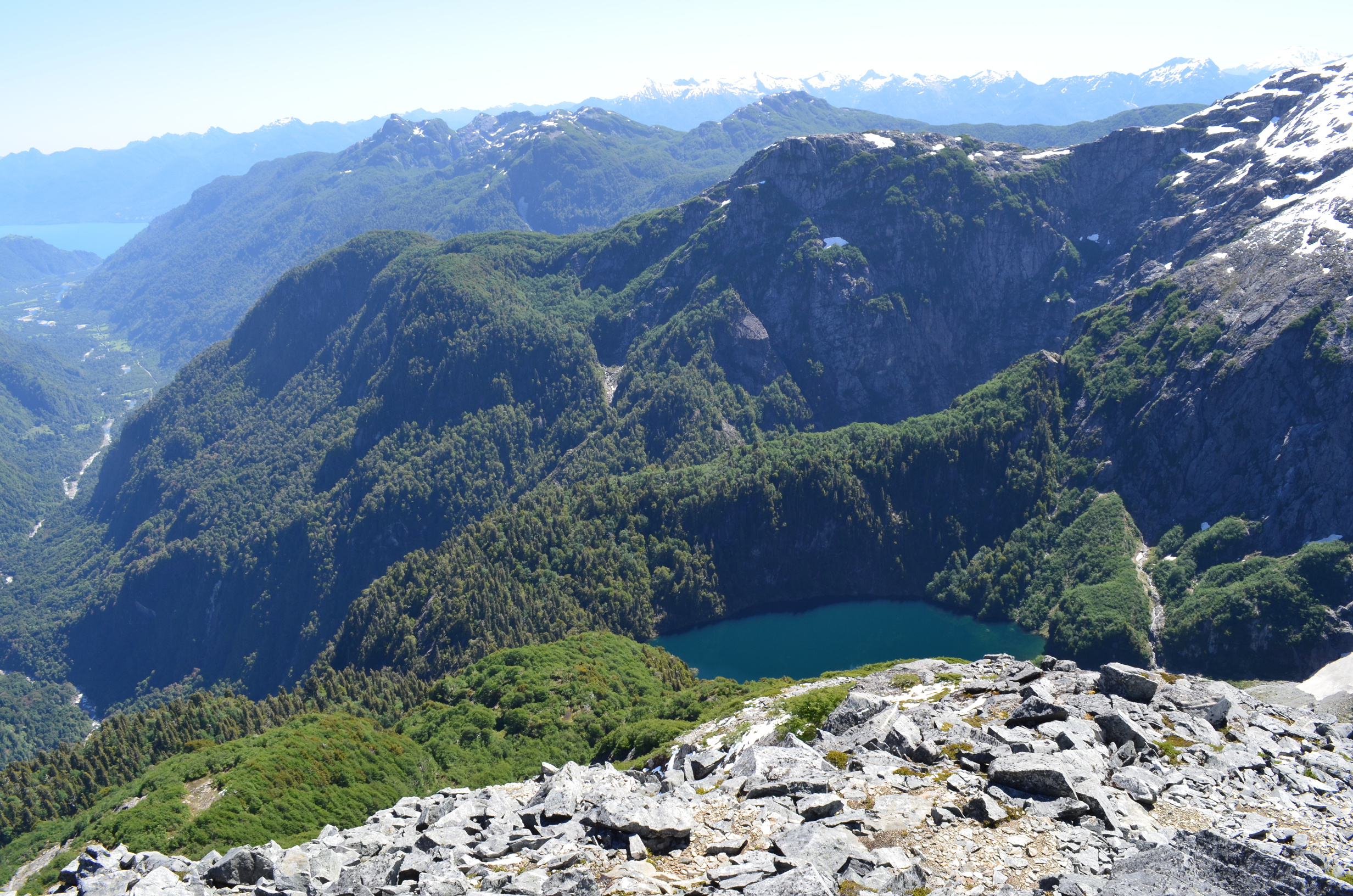
While heading back from the summit I take the time to enjoy the view from the ridge. Here I can see the valley I backpacked up, the fjord near Cochamó, and lots of mountains.
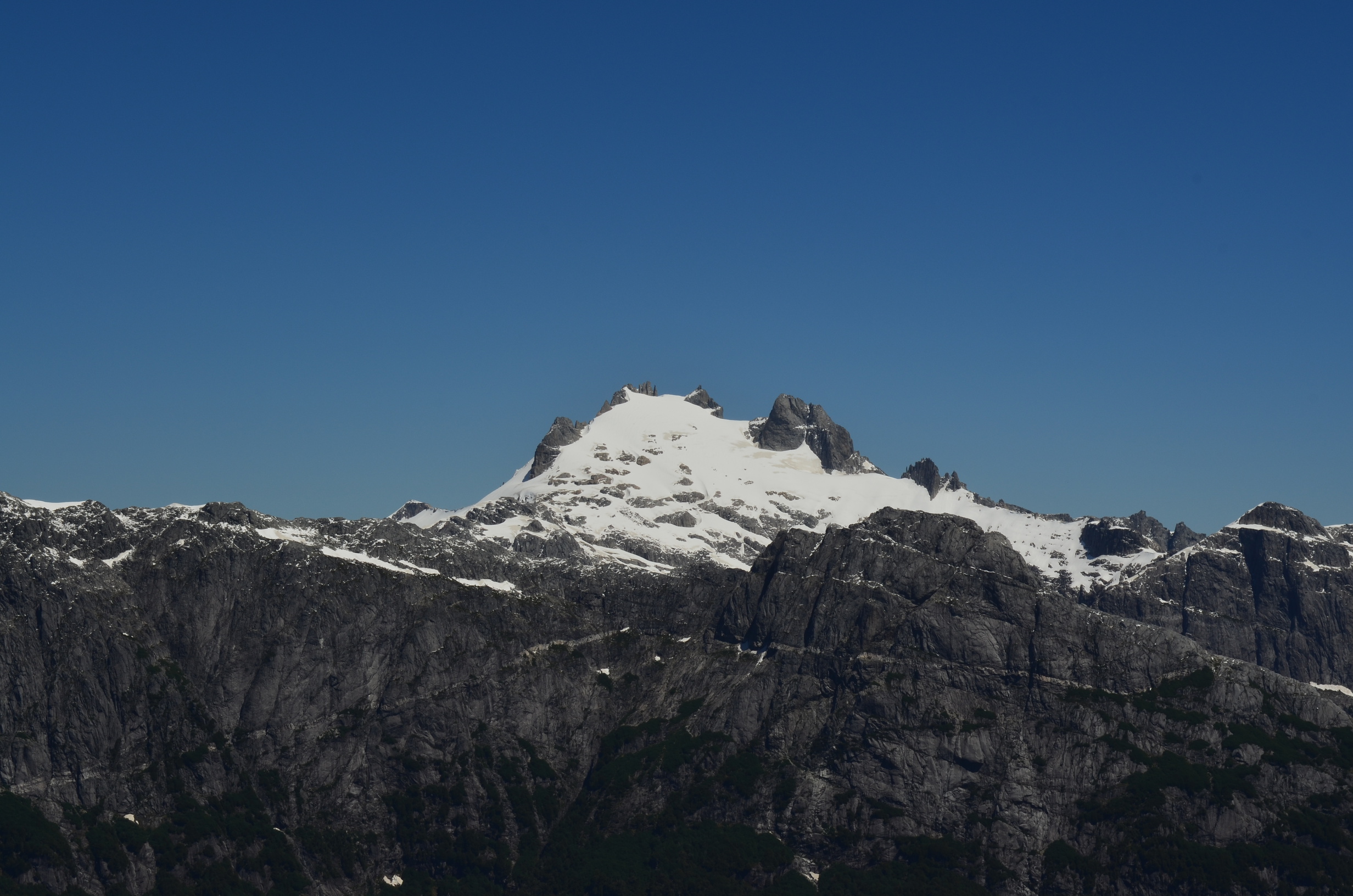
I enjoy the view and wonder which mountain I will fail to climb next. This one has a nice pointy shape and wonderful rock slopes.
This one has a cool lighter band of rock below, and looks kind of like a castle.
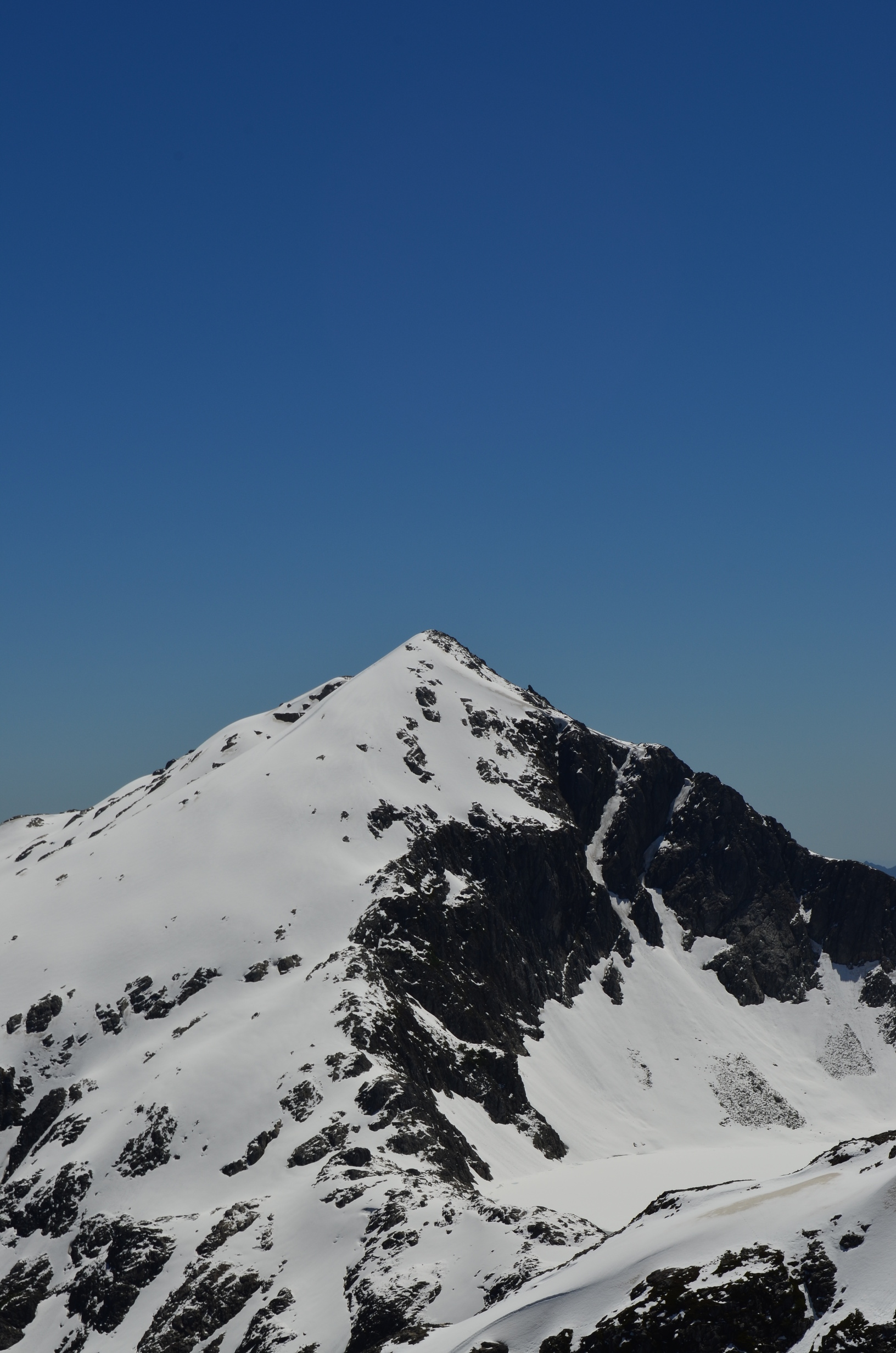
I will need to remember the ice ax for this one.
And I might want the rope if I ever try the face of Arco Iris.
One of the many volcanoes poking over the horizon. I believe this one is Osorno, but I need to check. They all look about the same.
One of the many hanging lakes found in the area. I want to go back with a small raft and float around in it. Though it would be one rough backpack, going cross country through very rugged terrain.
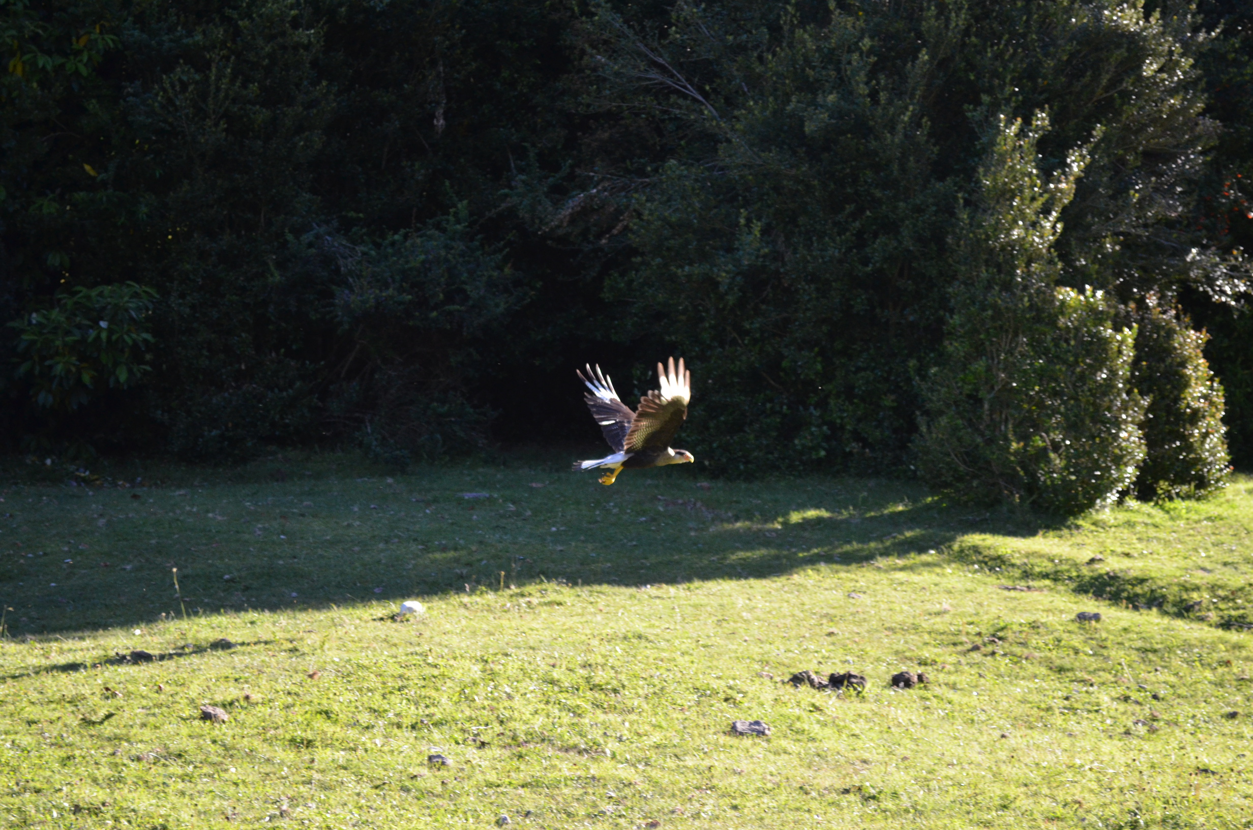
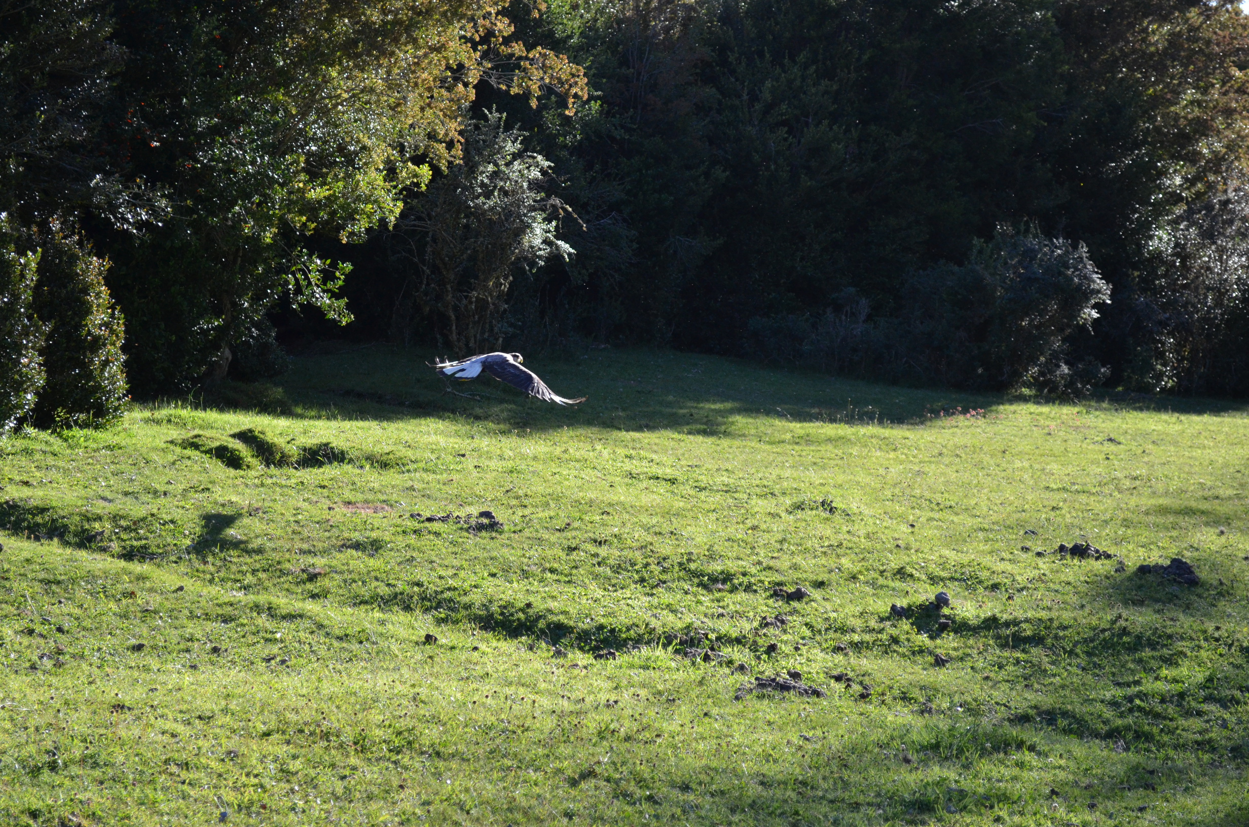
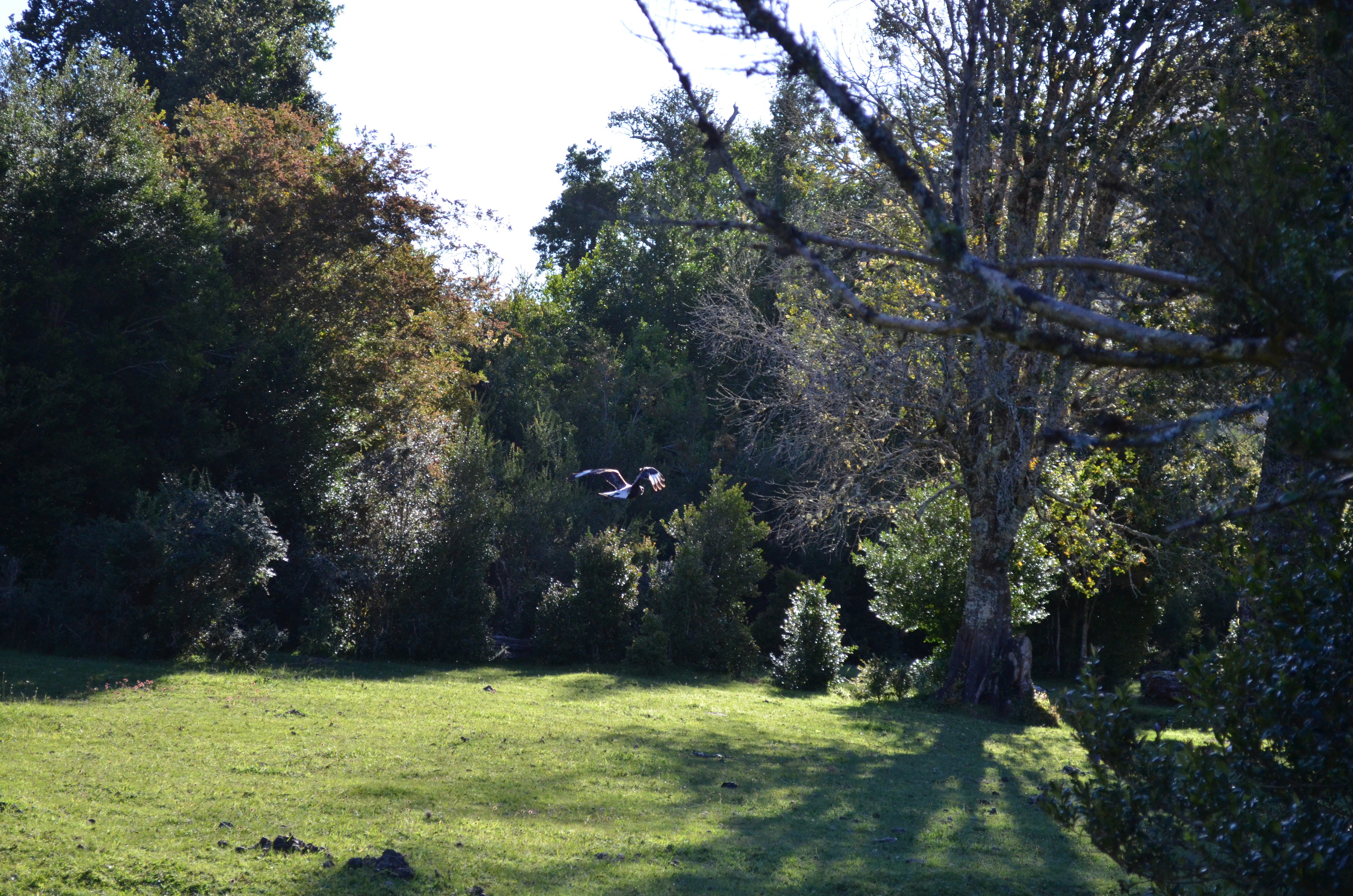
While I was away the birds checked out my camp. I caught this one as I returned. Upon seeing me it decided to promptly depart, and did not want to pose for a photo. I guess it didn't realize that if you try to loot someone's campsite you should at least be polite enough to pose for a good photo or two. One of those time I wish I had a better camera, but at least this one got some OK pictures.
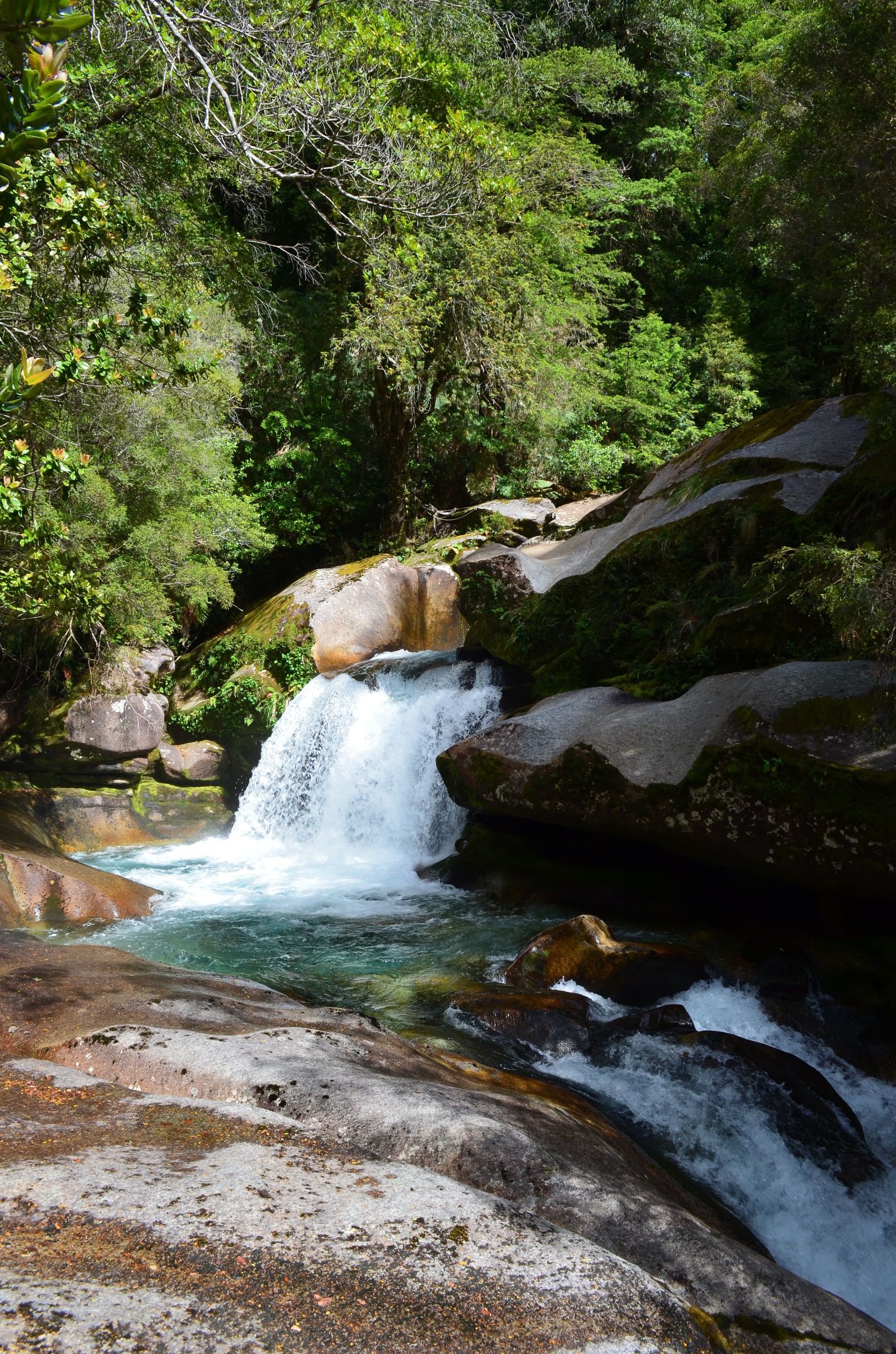
The next day I hiked upstream from camp. Here is a nice nearby waterfall.
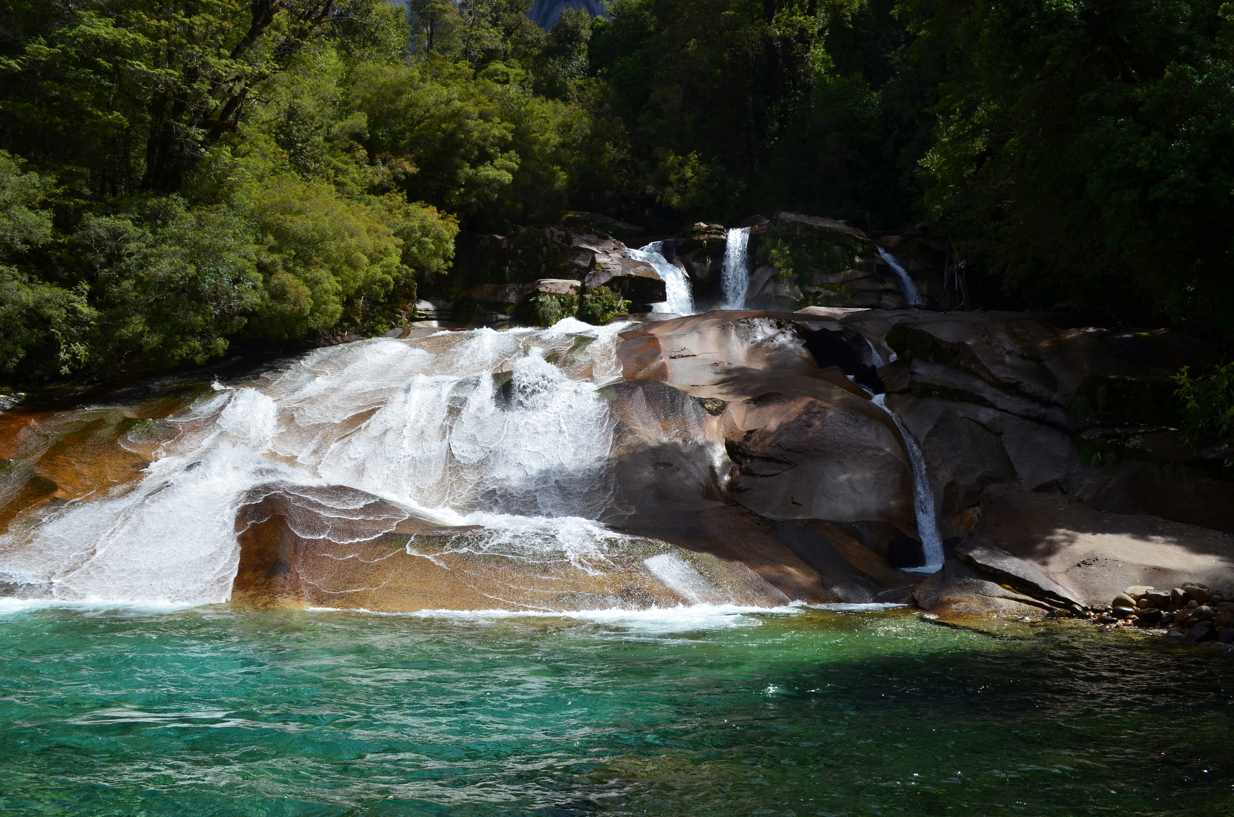
And an even nicer nearby waterfall. Makes me wish the water wasn't so cold; maybe later in the season...
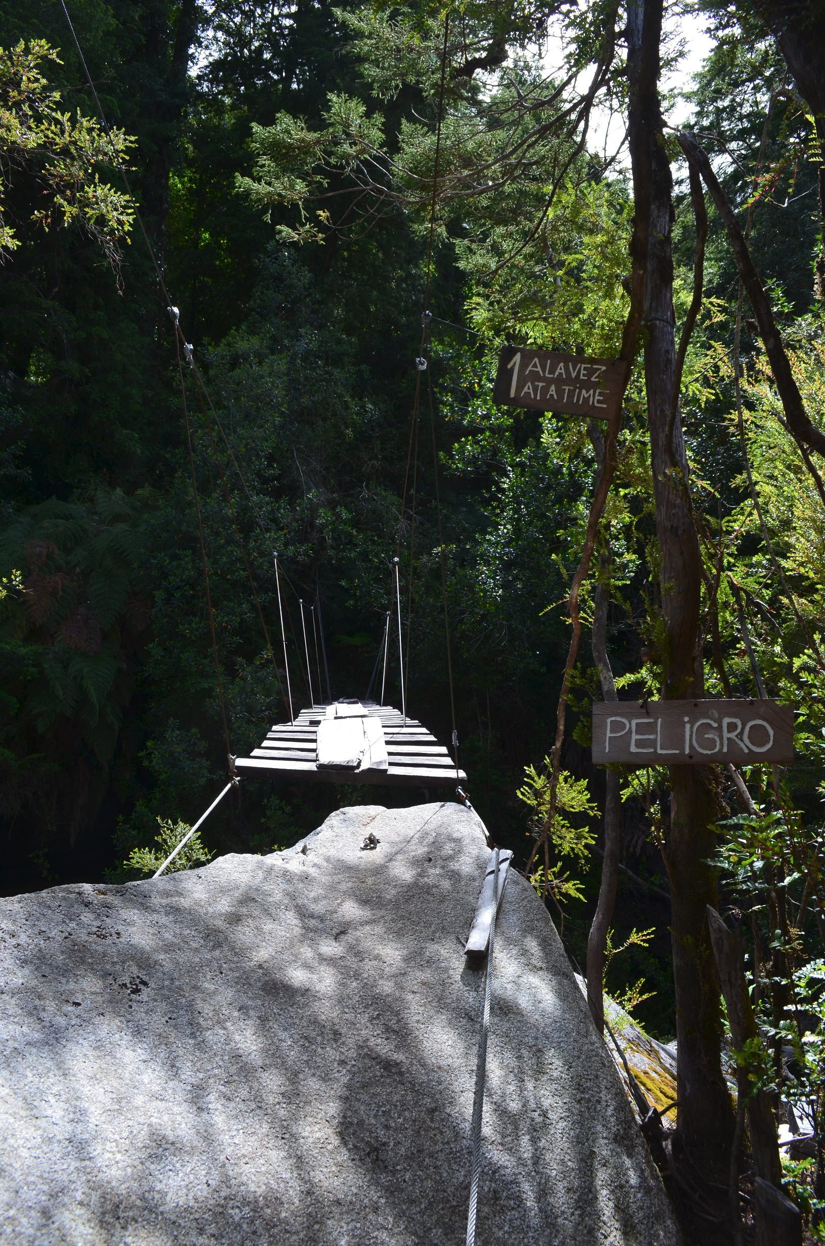
And they had a nice bridge, of which was worthy of an entry on Scary Bridges.
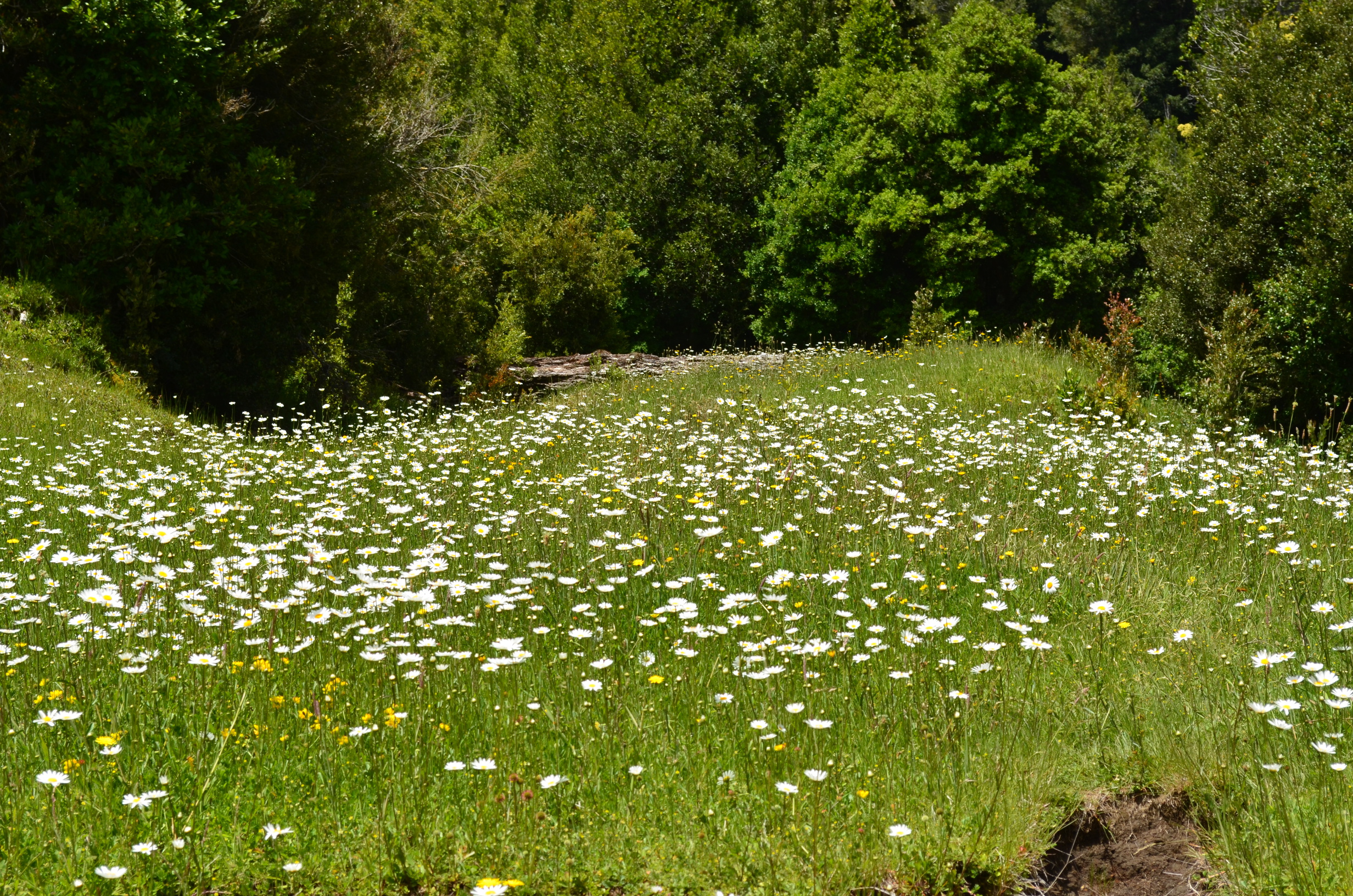
Upstream I found some nice flower patches.
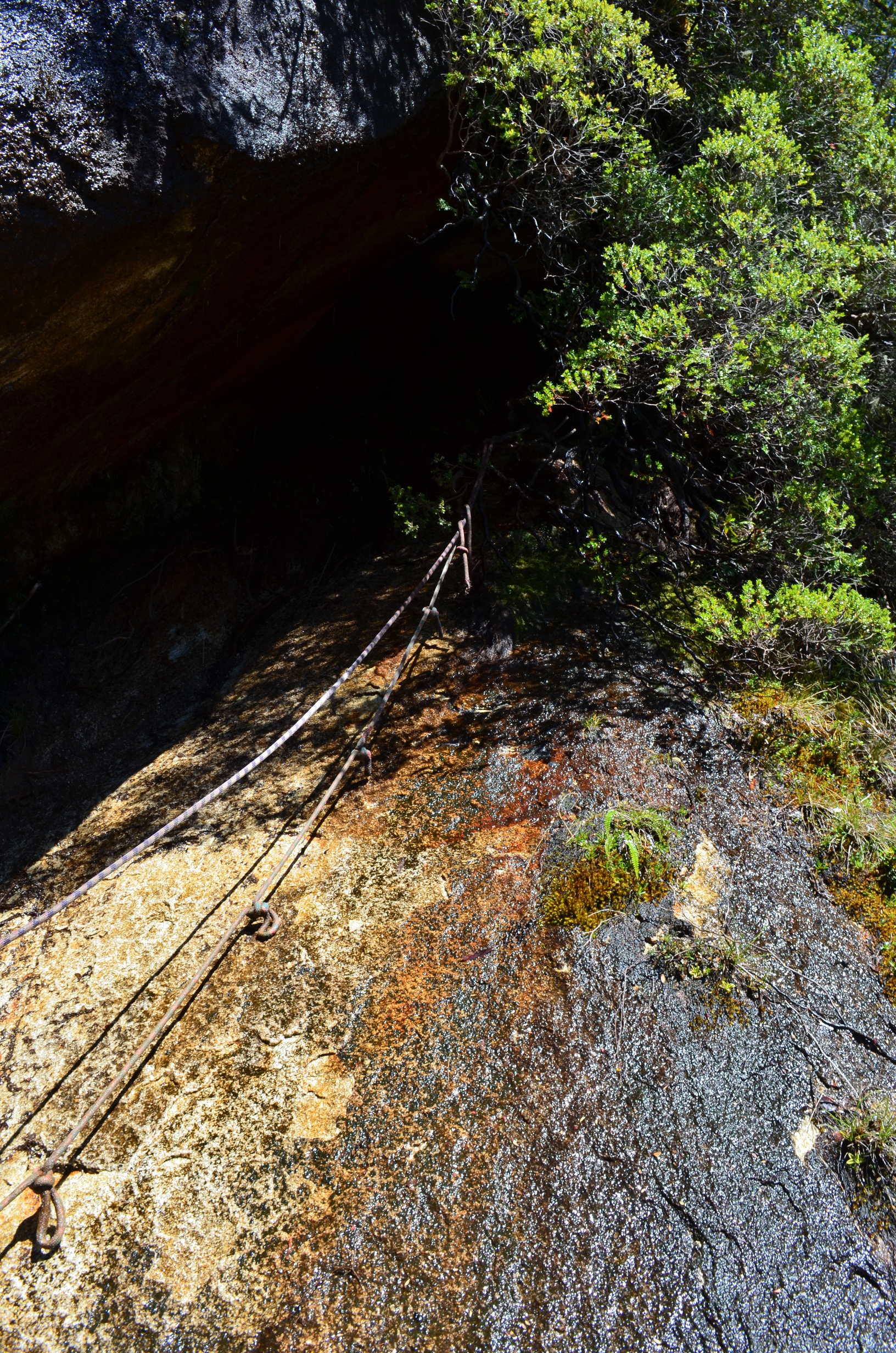
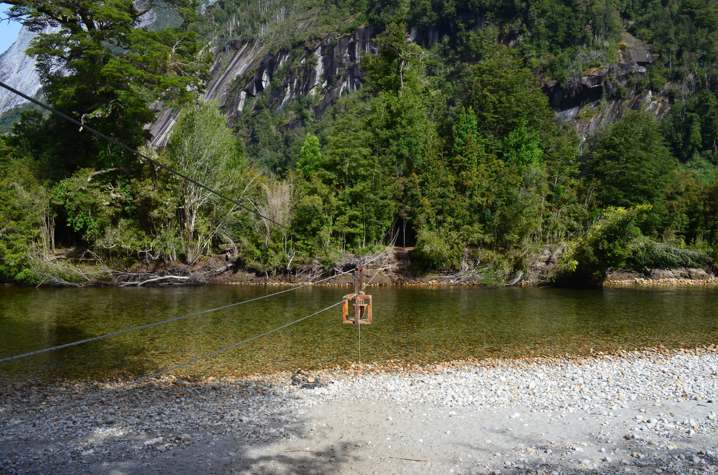
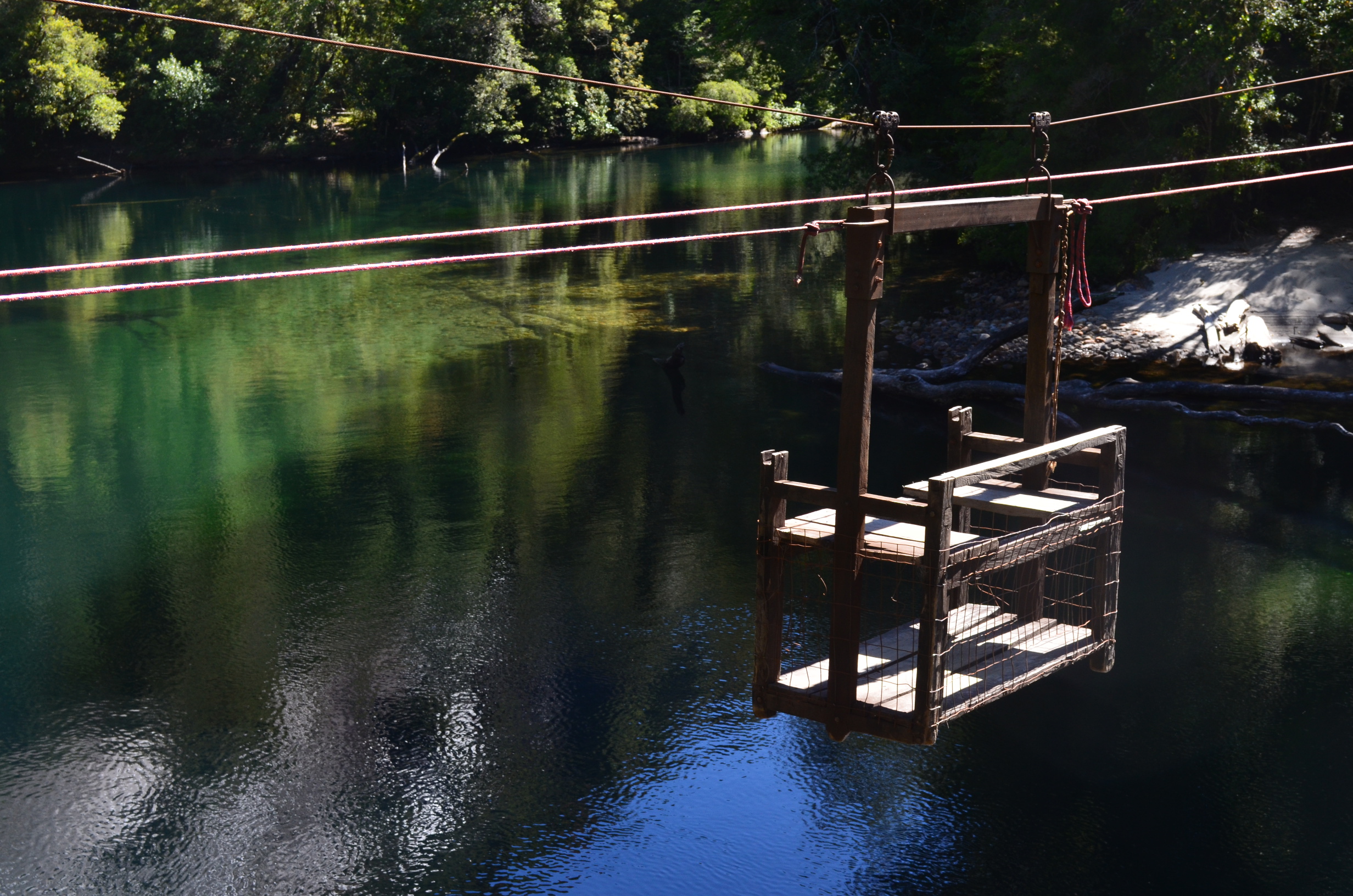
From where I camped the refugio is a river crossing and short walk away. Crossing the main river can be dangerous, depending on location and water depth. When there is one it is better to take one of the cable cars. A nice change from the U.S., where if there is a cable car it is locked up, closed off, and generally prohibited. I wish the US had more cable cars for hikers to cross obstacles. They are cheap and effective (until the lawyers get involved).
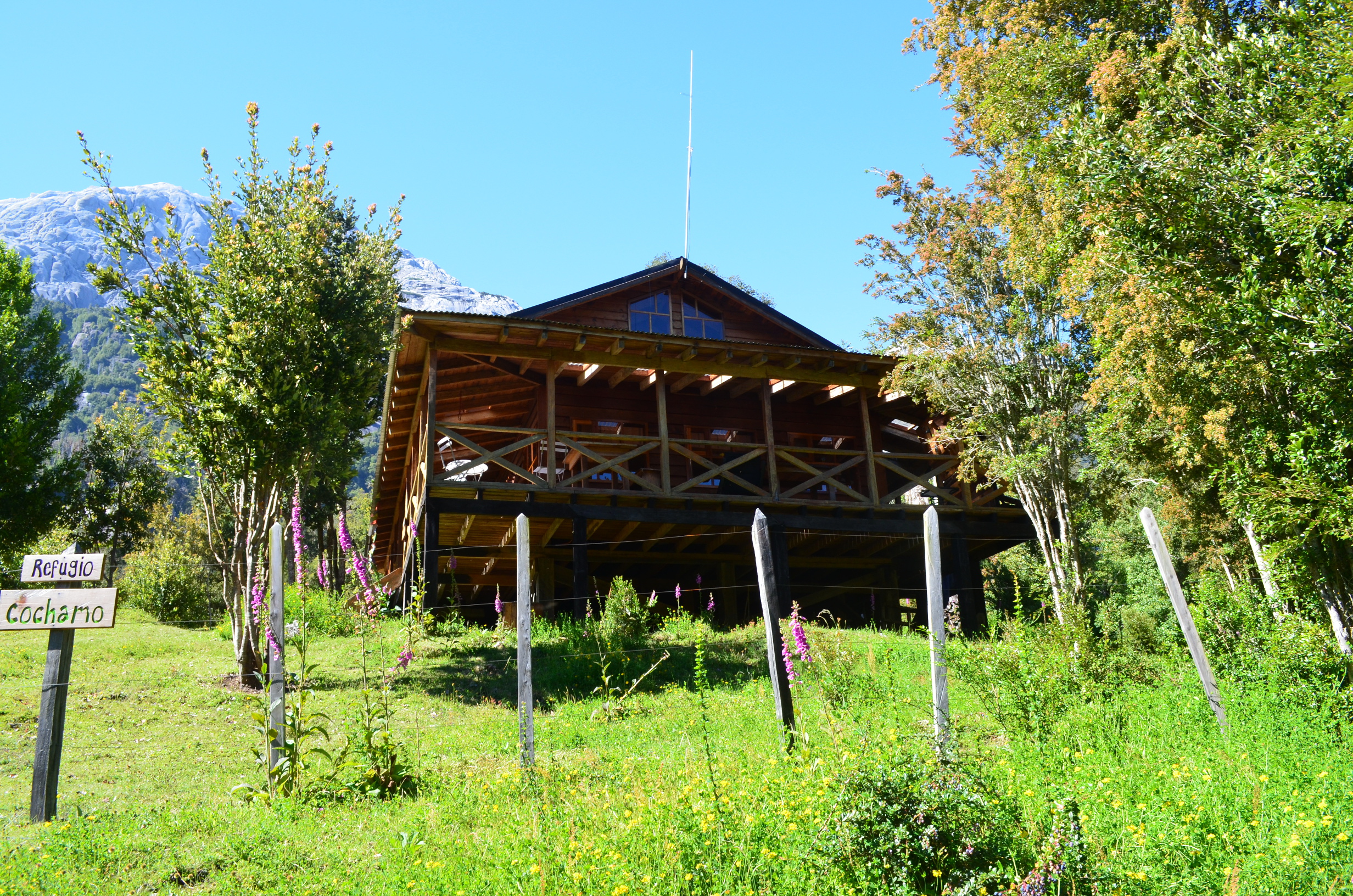
Refugio: A bed and breakfast located over 10km from the nearest road.
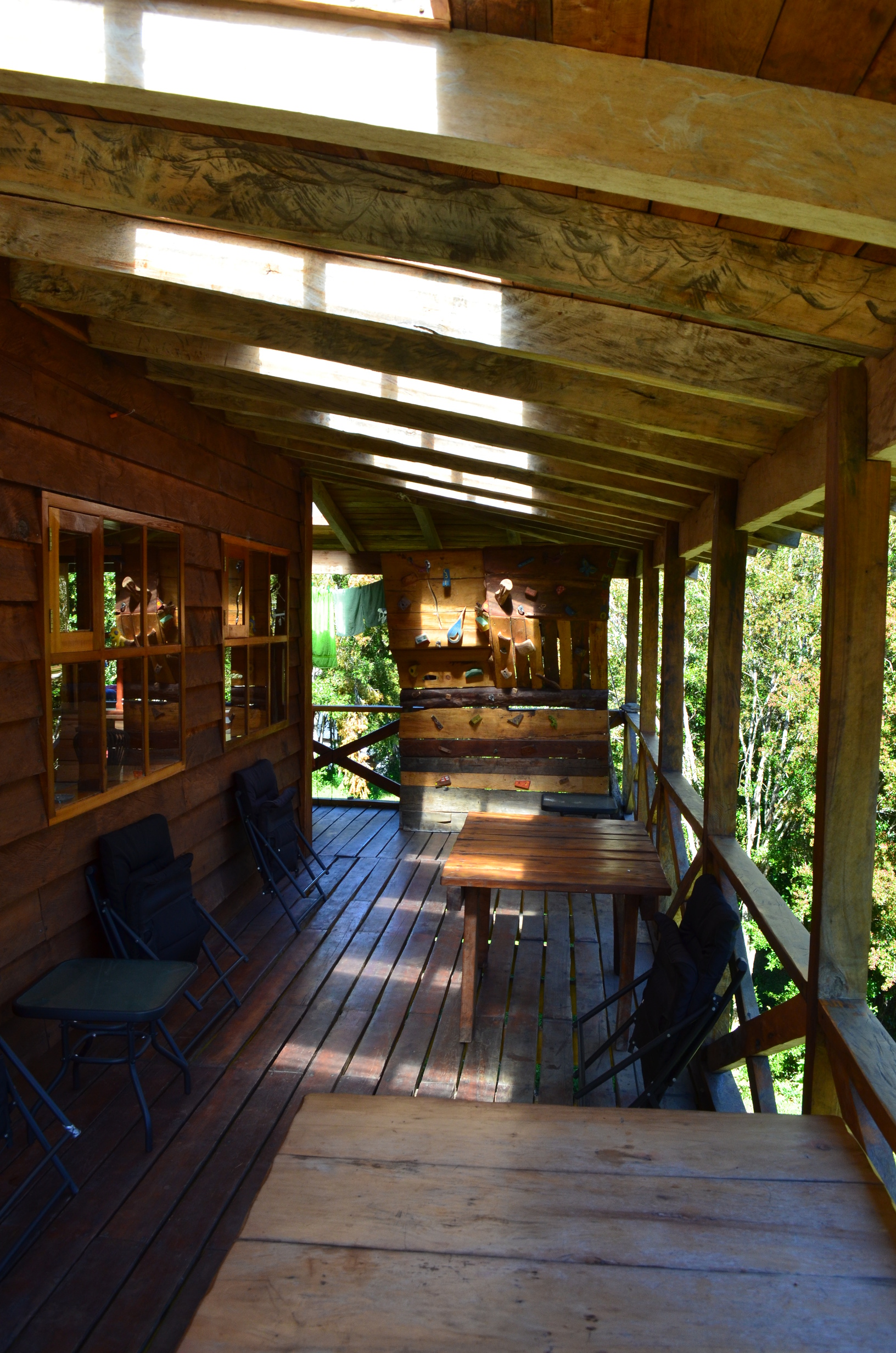
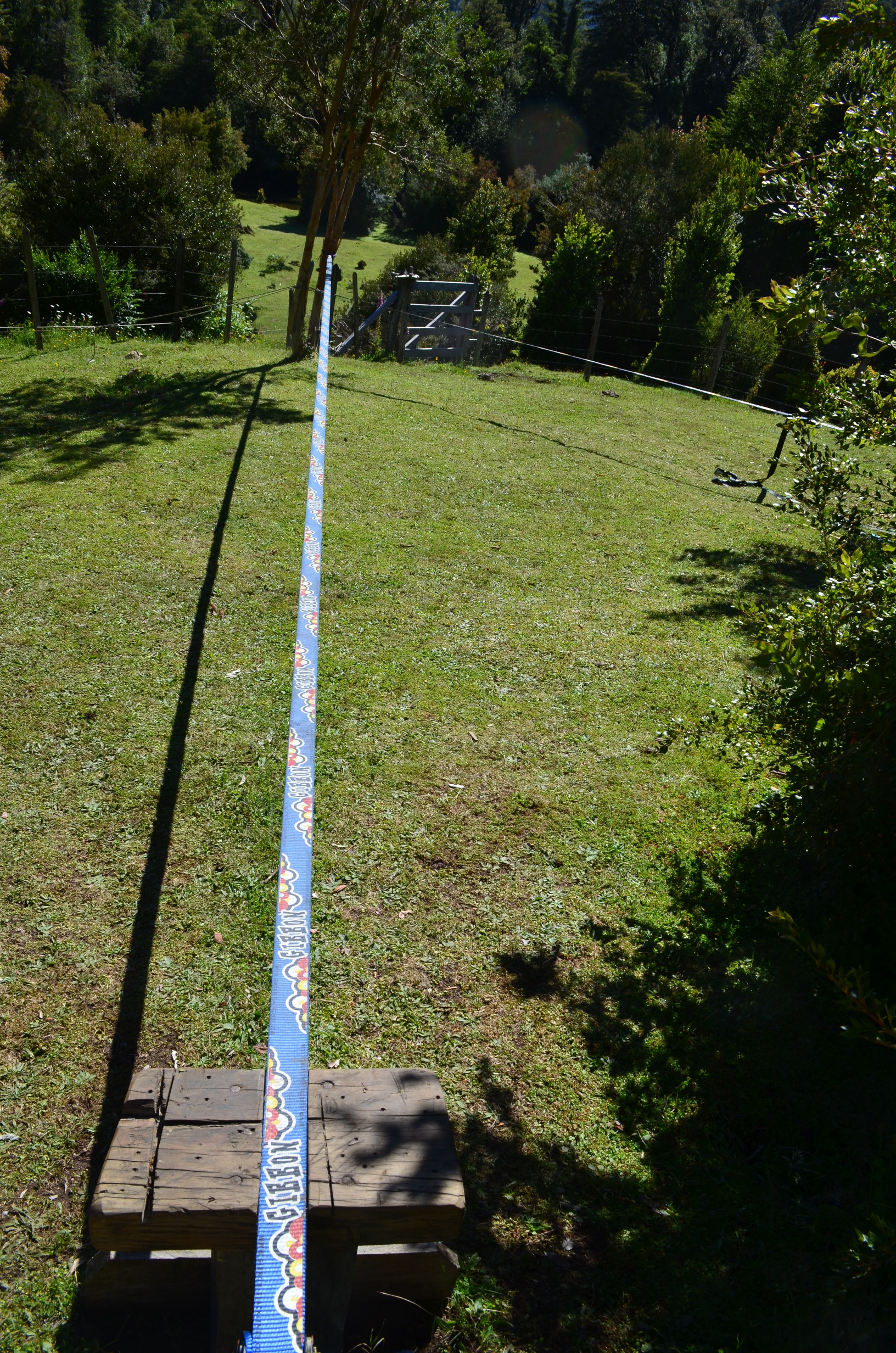
For relaxation after a hard day they had both a nice wrap around deck and a tightrope. Or, as climbers prefer to call it, a slackline.
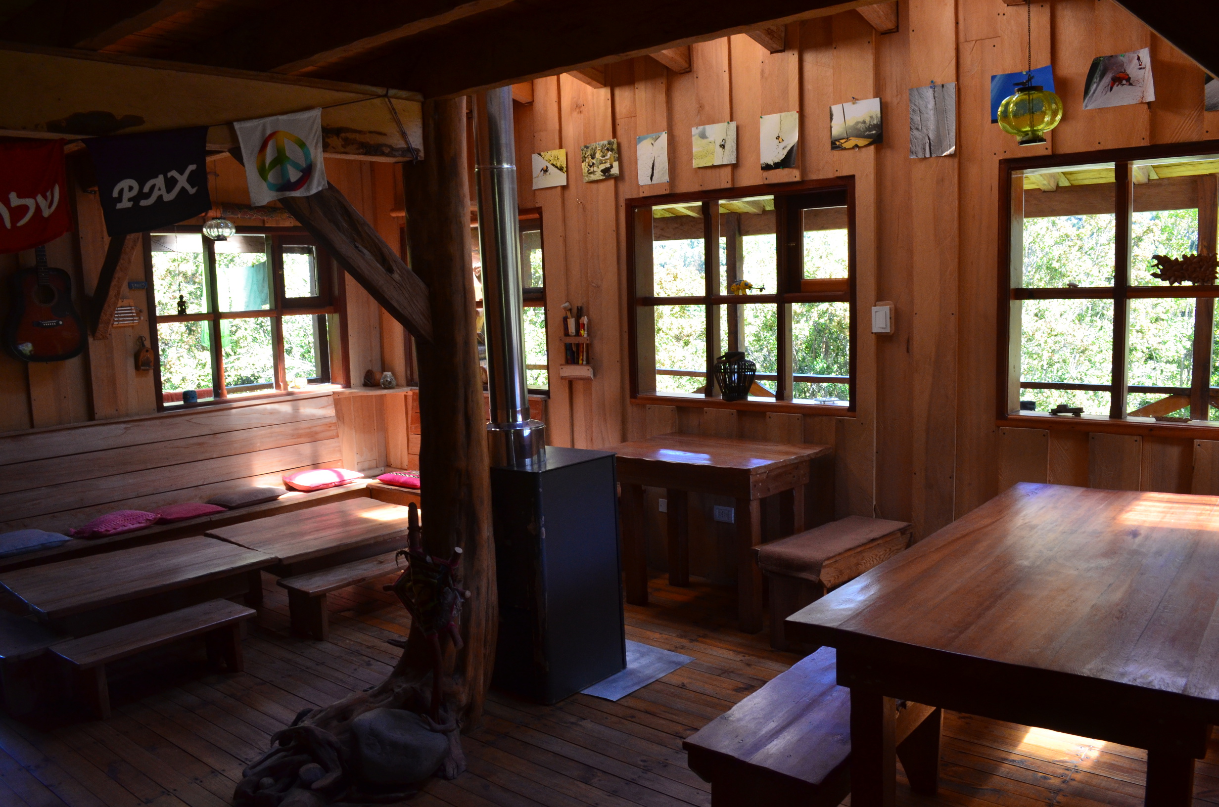
Inside the refugio was a nice dining room. Upstairs they have a shared bunk room and a private room (priced accordingly). More information here.
For my Chirstmas dinner I sprung for a pizza and hot coco. Well worth it after all the hiking.
With regret I head back after a few days. I wish I had longer, but it is a place well worth returning to. Even if a few of their cable cars are less than comforting.
The backpack out was uneventful. Thankfully some other backpackers give me a ride from near the trail head to the village of Cochamó. While doable, the long walk on the dirt road is not much fun.
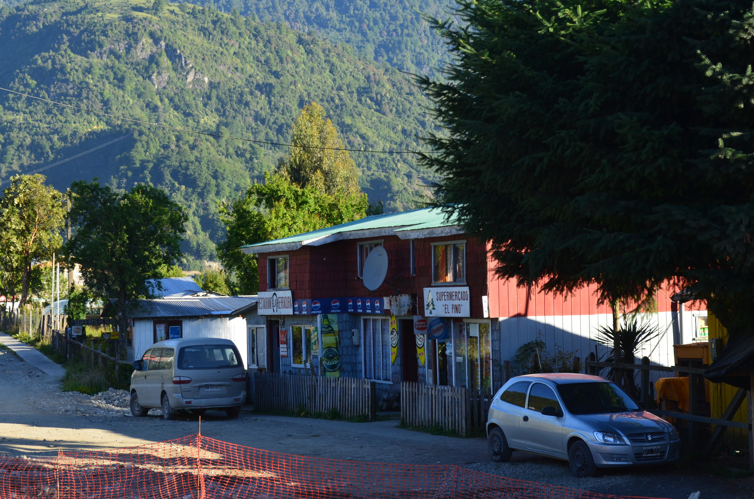
There was no chance of a bus back to Puerto Montt that day. I had to find a place to stay. In this case a combination cheap restaurant / little market / hostel. Nothing great but cheap and workable. While I would need to get up early in the morning, I still had some time to explore the town.
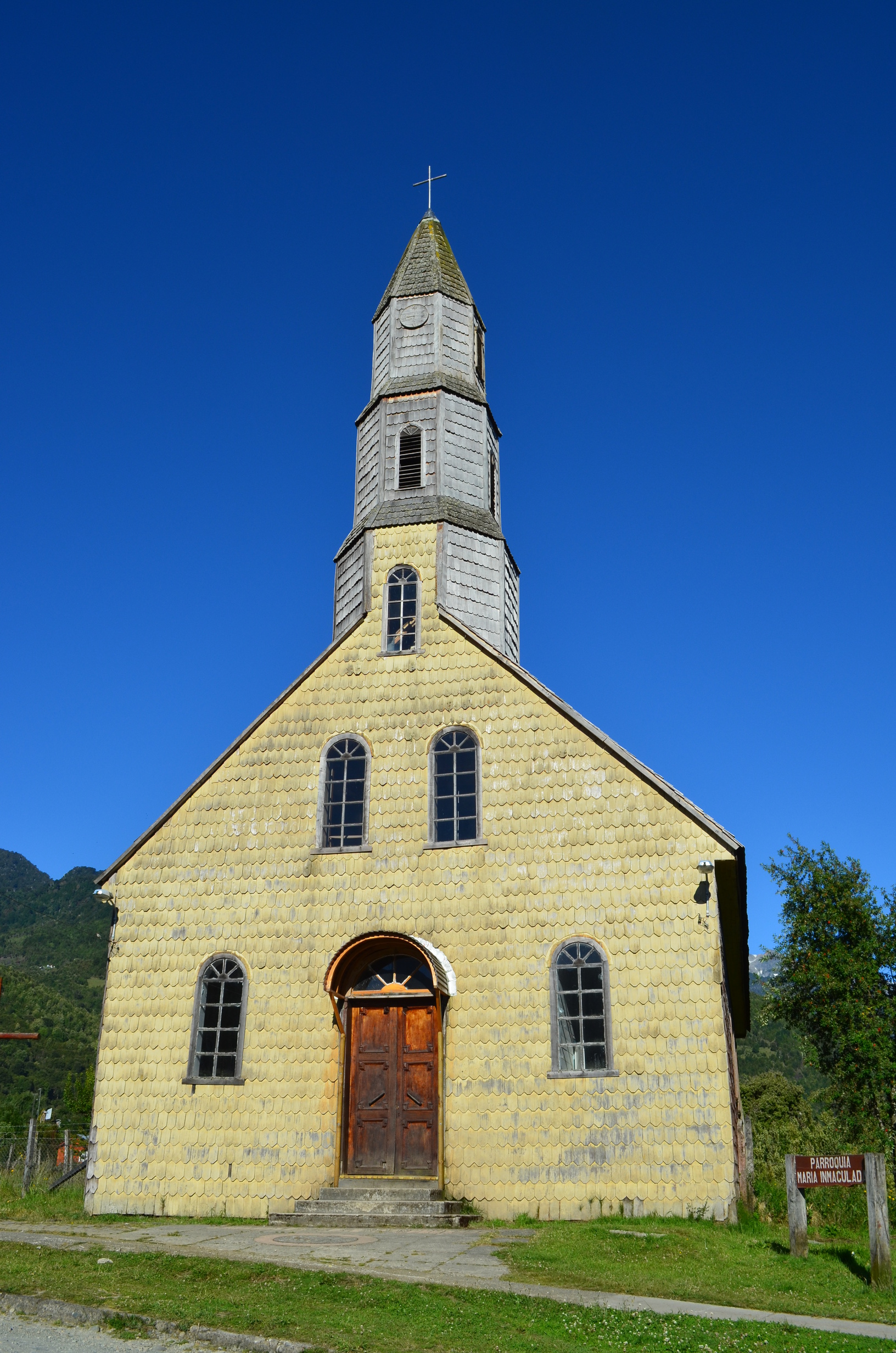
The iconic wooden church was easy to find. Being old and poorly maintained, it looks better in pictures than in person. None the less it is a cool building. It was not clear if it is still in use, but it was locked up when I was by there. Too bad; it would have been nice to see the inside.
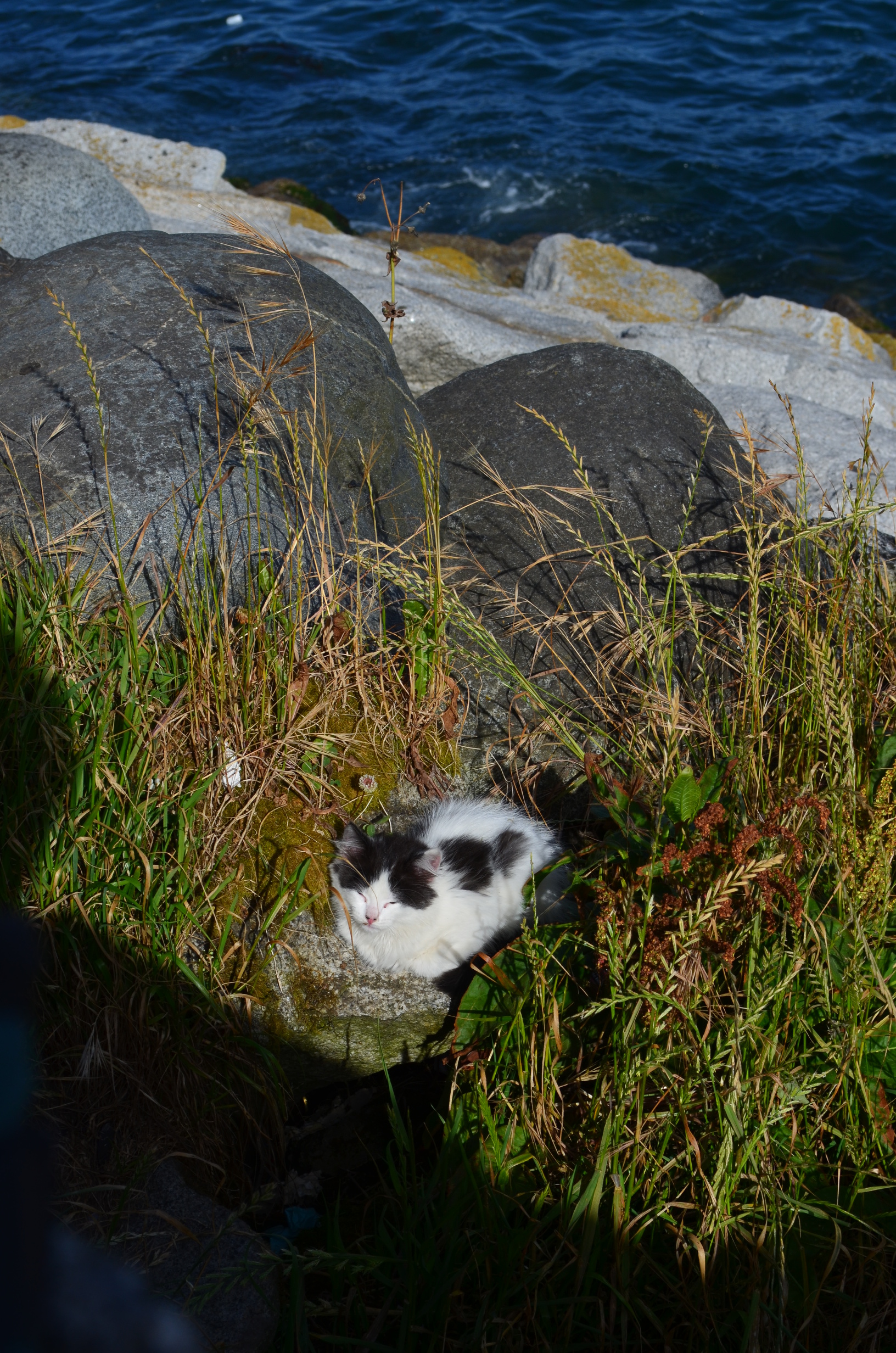
The next morning I caught the bus back to Purto Montt. It arrived around noon, leaving me a lot of time before catching the over night bus back to Santiago. I did my best to enjoy myself while looking forward to 14 hours in an undersized seat. I did a little shopping, enjoyed the good coffee shop, and found a dockside cat.
Last Updated: January 2015; Original Posting.
© David C. Hunter, 2011-2015
fb {at) dragonsdawn (dot] org